- General Info
- Demographics
- Education and Employment
- Valuation and Taxes Levied
- State Senators
- History
- County Programs
- Other Information
Communities & Development
Boyd County Seat: Butte
Total County Population: 1,674
- Villages (pop.): Anoka (9), Bristow, (69), Butte (257), Gross (2), Lynch (183), Monowi (1), Naper (82), Spencer (371)
- Unincorporated Pop. (% of county pop.): 699 (42%) 2025
Land Development (% of total land in county):
- Agriculture: 90%
- By method: Pasture (pure grassland (62%), Dryland (row crop/grain/forage) (26%), Irrigated (row crop/grain/forage) (3%) • Neb. Dept. of Rev. - total equals agriculture's %
- By commodity: Livestock (grassland) 60%, Corn 12%, Soybeans 7%, Alfalfa 6%, Oats 1% • USDA (NLCD) - equals agriculture's % plus some wetlands (3%) and some wooded grazing land (6%) and minus public grassland/wetlands and reserve
- Residential, Commercial, Industrial, Conservation Reserve & Exempt (combined): 10% 2022
County Offices
Courthouse Address and Hours:
401 Thayer Street
Butte, Nebraska 68722
M-F 8:15 am - 4:00 pm
Complete list of county board members
County Board Meetings: 4th Tuesday
View the County's Government Maps
NACO District: Northeast
General
Population: 1,674
Land area (sq. mi.): 539.94
Population per square mile: 3.4
Race & Age
Race 2024
White: 90.8%
African American: 0.2%
American Indian: 2.9%
Asian: 0.2%
Hispanic: 3.3%
Native Hawaiian and Pacific Islander: 0.0%
Two or More Races: 2.0%
Age 2024
0-17: 20.1%
18-64: 47.5%
65+: 32.2%
Households
Total households: 744 2024
With one child: 60 2023
With 2+ children: 100 2023
With seniors (65+): 170 2023
Socioeconomics
Median household income: $67,045 2024
% of population in poverty: 13.1% 2024
# of housing units: 1,203 2024
Owner-occupied rate: 80.9% 2024
Median home price: $108,290 Q4 2025
2025 building permits for detached single family homes: 0
2025 building permits for non-detached housing units: 0 (townhouse, duplex, or apt. unit)
Technology
Access to broadband (100 Mbps via fiber or cable model): 100% 2025
Sources: National Association of Realtors, Nebraska Department of Revenue, Nebraska Legislature, Nebraska Library Commission, U.S. Bureau of Economic Analysis, U.S. Census Bureau (demographics), U.S. Census Bureau (municipalities)
Employment, Schools, and Child Care
Unemployment rate: 3.9% February 2026
County Employment Website: https://nebraskacounties.org/nebraska-counties/county-employment-opportunities.html
High school graduate or higher: 96.4% 2024
School Districts: Boyd County Schools, Keya Paha Schools
Bachelor's degree or higher: 22.3% 2024
Community College Service Area: Northeast Community College
Countywide child care capacity: 1 providers; 12 children 2024
Find child care: For a list of child care providers in your zip code, visit Nebraska DHHS or the Nebraska Resource and Referral System.
Boyd County Economy
Annual Gross Domestic Product (GDP): $139,785,000 2024
Nonfarm Small Business Receipts: $28,824,611 2024
Nonfarm Wage Income: $24,906,000 2022
Farm and Ranch Commodity Sales Receipts: $81,405,000 2022
Farm and Ranch Operations (Non-Sales) Receipts: $4,707,000 2022
- For components of nonfarm small business receipts, nonfarm wage income, and farm & ranch commodity sales and operations receipts, see "Notes" below.
Grain Elevators by Location (bushels capacity):
- Lynch: Farmers Union (41,760)
- Spencer: Farmers Union (capacity unknown)
- (1 bushel = 56 lbs. corn/sorghum, 60 lbs. soybeans/wheat; % max. moisture = 18% beans, 15.5% corn, 14% sorghum/soybeans, 13.5% wheat)
Local Grain Market: Click for today's grain prices in Boyd County
Cattle Producers: 187
- Pastureland Cash Rent (avg.): $39/acre 2025
Crop Producers: 38
- Dryland Cash Rent (avg.): $118/acre 2025
Dairy Producers: 1
Electricity Providers: City of Spencer, Nebraska PPD, Niobrara Valley Electric Membership Corp.
Notes
- Nonfarm small business receipts are reported by partnerships and sole proprietorships. They do not include receipts reported by cooperative associations.
- Nonfarm wage income is reported based upon the wage earner's residential address; therefore, it also includes wages earned by Boyd County residents in other counties or states, but it excludes wages earned in Boyd County by residents of other counties or states.
- Nonfarm wage income excludes wages earned by anyone claimed as a dependent.
- Farm and ranch commodity sales receipts and operations receipts are reported based upon the farm or ranch owner's principal county of operations; therefore, those figures also include receipts reported by producers operating principally in Boyd County for their production in other counties or states, but the figures exclude receipts reported for production in Boyd County by producers operating principally in other counties or states.
Irrigation, Drinking Water, and Soils
Rural Irrigation/Livestock Wells: 161 2024
Rural Commercial/Industrial Wells: 1 2024
Rural Drinking Water Wells: 33 2024
Drinking Water Utility Connections: 1,232 Residential; 172 Commercial; 15 Agricultural 2024
Irrigation/Livestock Wells per Square Mile: 0.30 2024
Surface Water Diversions (Irrigation): 82 2024
Sources: National Agricultural Statistics Service (USDA), Nebraska Cooperative Council, Nebraska Coordinating Commission for Postsecondary Education, Nebraska Department of Health and Human Services, Nebraska Department of Revenue, Nebraska Department of Transportation, Nebraska Office of the CIO, Nebraska Power Review Board, Nebraska Public Service Commission, U.S. Bureau of Economic Analysis, U.S. Bureau of Labor Statistics, U.S. Census Bureau, U.S. Energy Information Administration, U.S. Department of the Treasury (IRS), Warehouse and Commodity Management Division (USDA)
2025 Levies and Valuations
County levy rate: $0.293 per $100 of taxable valuation
County property taxes levied: $2,349,992
Total local government property taxes levied: $7,934,882
Total countywide taxable valuation: $802,188,741
Click here for all levy rates in Boyd County
County Levy and Taxation Laws
Levy limits
Since 1996, counties and other political subdivisions have been subject to the levy limits listed in Neb. Rev. Stat. § 77-3442 and Neb. Rev. Stat. § 77-3443.
Statutes and regulations
Nebraska Revised Statutes (Chapter 77)
Nebraska Administrative Code (Title 350)
Local tax reductions, exemptions, and credits:
Neb. Rev. Stat. § 76-902(5)(a) (Deed "stamp tax" exemption): "The [stamp tax] shall not apply to: ... (5)(a) Deeds between spouses, between ex-spouses for the purpose of conveying any rights to property acquired or held during the marriage, or between parent and child, without actual consideration therefor."
Neb. Rev. Stat. § 77-201(2) (Valuation of agricultural land and horticultural land): "Agricultural land and horticultural land as defined in section 77-1359 shall constitute a separate and distinct class of property for purposes of property taxation, shall be subject to taxation, unless expressly exempt from taxation, and shall be valued at seventy-five percent of its actual value, except that for school district taxes levied to pay the principal and interest on bonds that are approved by a vote of the people on or after January 1, 2022, such land shall be valued at fifty percent of its actual value."
Neb. Rev. Stat. § 77-6703(1) (Tax credit for school district taxes paid): "(1) For taxable years beginning or deemed to begin on or after January 1, 2020, under the Internal Revenue Code of 1986, as amended, there shall be allowed to each eligible taxpayer a refundable credit against the income tax imposed by the Nebraska Revenue Act of 1967 or against the franchise tax imposed by sections 77-3801 to 77-3807. The credit shall be equal to the credit percentage for the taxable year, as set by the department under subsection (2) of this section, multiplied by the amount of school district taxes paid by the eligible taxpayer during such taxable year."
Sources: Nebraska Department of Revenue
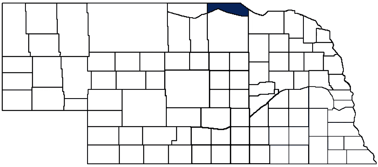
State Senator: Tanya Storer (District 43)
Committees:
Map and statistics for Legislative District 43
Map of all districts in the Nebraska Unicameral Legislature

Boyd County History
Number of Registered Historic Places: 5
Year Authorized: 1891
Year Organized: 1891
Etymology: James Boyd (Nebraska’s 8th Governor)
One of Boyd County’s defining characteristics is its unique geography. Bordered by the Missouri River to the northeast and the Niobrara River to the South, the county measures 48 miles from east to west, but only 6-15 miles north to south. As implied by the name of the county’s seat, Butte, there are several rock formations across the county, some of which reach 200 high. These buttes are composed of multiple layers of hard rock, sand, clay, and shale, consistent with other formations caused by wind and weather erosion.
As with most Nebraska counties, Boyd County was originally inhabited by Native Americans. In the 1880’s, the U.S. government wanted to open the Sioux Reservation for settlement. However, the Sioux resisted, concerned about the scarcity and allocation of the area’s natural resources. Local accounts recall the Sioux chief’s plea, “We cannot eat dirt.” Pressure from government and military officials mounted, and the Sioux tribe eventually acquiesced.
In 1891, the Nebraska Legislature organized the county and named it after then-Governor James E. Boyd. Although Nebraska gained territory from South Dakota in 1867, the state line had not been accurately surveyed in 1895. For a time, settlers in some parts of Boyd County were unsure of their actual state of residence. Today, Boyd County is part of a seven-county area referred to as the “Nebraska Outback” by a tourism campaign highlighting the region’s natural beauty, frontier landscapes, and remote destinations.
Highlight an important program in your county in this space! Send an email to:
Local Highlights
License Plate Number: 63
Time Zone: Central
Number of Veterans: 148 2026
Zoned County: Yes
Number of County-Owned Bridges: 49
Number of County-Owned Dams: 2
Election Data
General Election Turnout: 85% 2024
Total Registered Voters: 1,264 2024
Number of Precincts: 3 2024
Number of Election Day Polling Places: 3 2024
Land Area per Polling Place: 179.98 sq. miles
Intergovernmental Data
Emergency Mgt. Planning, Exercise and Training (PET) Region: North Central/Sandhills
Natural Resource District: Lower Niobrara NRD
State Lands (acres): Hull Lake WMA (5.5), Parshall Bridge WMA (226.51), Sunshine Bottoms WMA (4.94)
Sources: Nebraska Department of Transportation, Nebraska Emergency Management Agency, Nebraska Game & Parks Commission, Nebraska Legislature, Nebraska Office of the CIO, Nebraska Secretary of State, U.S. Department of Veterans Affairs, U.S. Election Assistance Commission, U.S. National Archives and Records Administration (eCFR)