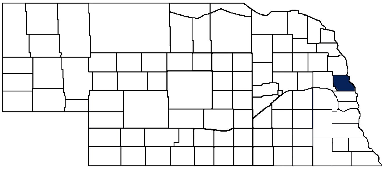
- General Info
- Demographics
- Education and Employment
- Valuation and Taxes Levied
- State Senators
- History
- County Programs
- Other Information
Communities and Development
Washington County Seat: Blair
Total County Population: 20,865
- Cities (pop. & class): Blair (7,790 • 2nd Class), Fort Calhoun (1,108 • 2nd Class)
- Villages (pop.): Arlington (1,300), Herman (247), Kennard (381), Washington (129)
- Unincorporated Pop. (% of county pop.): 9,910 (48%) 2020
Land Development (% of total land in county):
- Agriculture: 77%
- By method: Dryland (row crop/grain/forage) (61%); Pasture (pure grassland) (10%); Irrigated (row crop/grain/forage) (7%) • Neb. Dept. of Rev. - total equals agriculture's %
- By commodity: Corn 35%, Soybeans 33%, Livestock (grassland) 11%, Alfalfa 3% • USDA - equals agriculture's % plus some wetlands (3%) and minus public grassland/wetlands and reserve
- Residential, Commercial, Industrial, Conservation Reserve & Exempt (combined): 23% 2022
County Offices
Courthouse Address and Hours:
1555 Colfax St
Blair NE 68008
M-F 8:00 am - 4:30 pm
Complete list of county board members
County Board Meetings: 2nd & 4th Tuesday
View the County's Government Maps
NACO District: Northeast
General
Population: 20,865
Land area (sq. mi.): 389.96
Population per square mile: 53.5
Race and Age
Race 2020
White: 92.8%
African American: 0.3%
American Indian: 0.1%
Asian: 0.5%
Hispanic: 3.0%
Native Hawaiian and Pacific Islander: 0.0%
Two or More Races: 3.1%
Age 2020
0-17: 23.9%
18-64: 57.6%
65+: 18.5%
Households
Total households: 8,115 2020
With one child: 990 2022
With 2+ children: 1,470 2022
With seniors (65+): 2,250 2022
Socioeconomics
Median household income: $90,188 2023
% of Population in Poverty: 7.1% 2023
# of Housing Units: 8,557 2020
Owner-occupied rate: 80.2% 2020
Median home price: $291,190 Q4 2024
2024 building permits for detached single family homes: 80
2024 building permits for non-detached housing units: 0 (townhouse, duplex, or apt. unit)
Technology
Access to broadband (100 Mbps via fiber or cable modem): 19.4% 2021
Sources: National Association of Realtors, Nebraska Department of Revenue, Nebraska Legislature, Nebraska Library Commission, U.S. Bureau of Economic Analysis, U.S. Census Bureau (building permits), U.S. Census Bureau (demographics), U.S. Census Bureau (municipalities)
Employment, Schools, and Child Care
Unemployment rate: 2.5% March 2025
County Employment Website: https://www.washingtoncountyne.gov/careers
High school graduate or higher: 95.5% 2020
School Districts: Arlington Public Schools, Bennington Public Schools, Blair Community Schools, Fort Calhoun Community Schools, Logan View Public Schools, Tekamah-Herman Community Schools
Bachelor's degree or higher: 32.1% 2020
Community College Service Area: Metropolitan Community College
Countywide child care capacity: 29 providers; 1,208 children 2024
Find child care: For a list of child care providers in your zip code, visit Nebraska DHHS or the Nebraska Resource and Referral System.
Washington County Economy
Annual Gross Domestic Product (GDP): $1,850,653,000 2023
Nonfarm Small Business Receipts: $265,076,173 2022
Nonfarm Wage Income: $662,447,000 2022
Farm and Ranch Commodity Sales Receipts: $182,733,000 2022
Farm and Ranch Operations (Non-Sales) Receipts: $9,308,000 2022
- For components of nonfarm small business receipts, nonfarm wage income, and farm & ranch commodity sales and operations receipts, see "Notes" below.
Ethanol Plants (annual production capacity): Cargill (210 million gallons)
Grain Elevators by Location (bushels capacity):
- Blair: Mathiesen (1,263,690), Norag (417,000), Tyson (979,761)
- (1 bushel = 56 lbs. corn/sorghum, 60 lbs. soybeans/wheat; % max. moisture = 18% beans, 15.5% corn, 14% sorghum/soybeans, 13.5% wheat)
Railroad Miles: 25.02 main, 18.16 side
- Places with Railroad Service: Arlington, Blair, Kennard
Local Grain Market: Click for today's grain prices in Washington County
Cattle Producers: 159
Crop Producers: 86
- Dryland Cash Rent (avg.): $235/acre 2024
- Irrigated Land Cash Rent (avg.): $283/acre 2024
Dairy Producers: 1
Electricity Providers: Burt County PPD, Omaha PPD
Irrigation and Drinking Water
Rural Irrigation Wells: 161 2024
Rural Livestock Wells: 20 2024
Rural Commercial/Industrial Wells: 7 2024
Rural Drinking Water Wells: 609 2024
Drinking Water Utility Connections: 5,483 Residential; 544 Commercial; 4 Industrial 2024
Surface Water Diversions (Irrigation): 86 2024
Click for real time:
Streamflow data on Big Papillion Creek near Blair
Streamflow data on Big Papillion Creek near Kennard
Notes
Washington County Economy
- Nonfarm small business receipts are reported by partnerships and sole proprietorships. They do not include receipts reported by cooperative associations.
- Nonfarm wage income is reported based upon the wage earner's residential address; therefore, it also includes wages earned by Washington County residents in other counties or states, but it excludes wages earned in Washington County by residents of other counties or states.
- Nonfarm wage income excludes wages earned by anyone claimed as a dependent.
- Farm and ranch commodity sales receipts and operations receipts are reported based upon the farm or ranch owner's principal county of operations; therefore, those figures also include receipts reported by producers operating principally in Washington County for their production in other counties or states, but the figures exclude receipts reported for production in Washington County by producers operating principally in other counties or states.
Irrigation and Drinking Water
- A rural irrigation well is any well intended for irrigating crops that, either on its own or as part of a set of commingled wells, is capable of pumping more than fifty (50) gallons of water per minute (gpm). Note that some rural commercial/industrial wells are also capable of pumping more than 50 gpm. In Nebraska, the owner of any well--or set of commingled wells--that is capable of pumping more than 50 gpm must register the well(s) with the state government and have a permit for the well(s) from the local natural resource district (NRD).
- Rural livestock wells and rural drinking water (also known as "domestic") wells are not allowed to pump more than 50 gpm unless permitted by the local NRD. Each rural drinking water well usually serves one single family home, though in rare cases a rural drinking water well serves multiple homes.
- Data on rural livestock wells and rural drinking water wells may be incomplete for wells drilled prior to September 9, 1993. State law does not require wells drilled prior to that date to be registered with the state government if the wells are not capable of pumping more than 50 gpm. Neb. Rev. Stat. § 46-735; see Laws 1993, LB 131, § 25.
Sources: National Agricultural Statistics Service (USDA), Nebraska Cooperative Council, Nebraska Coordinating Commission for Postsecondary Education, Nebraska Department of Health and Human Services, Nebraska Department of Revenue, Nebraska Department of Transportation, Nebraska Office of the CIO, Nebraska Power Review Board, Nebraska Public Service Commission, U.S. Bureau of Economic Analysis, U.S. Bureau of Labor Statistics, U.S. Census Bureau, U.S. Energy Information Administration, U.S. Department of the Treasury (IRS), Warehouse and Commodity Management Division (USDA)
2023 Levies and Valuation
County levy rate: $0.2635per $100 of taxable valuation
County property taxes levied: $12,334,047
Total local government property taxes levied: $63,432,004
Total countywide taxable valuation: $4,681,061,578
Click here for all levy rates in Washington County
County Levy and Taxation Laws
Levy limits
Since 1996, counties and other political subdivisions have been subject to the levy limits listed in Neb. Rev. Stat. § 77-3442 and Neb. Rev. Stat. § 77-3443.
Statutes and regulations
Nebraska Revised Statutes (Chapter 77)
Nebraska Administrative Code (Title 350)
Local tax reductions, exemptions, and credits
Neb. Rev. Stat. § 76-902(5)(a) (Deed "stamp tax" exemption): "The [stamp tax] shall not apply to: ... (5)(a) Deeds between spouses, between ex-spouses for the purpose of conveying any rights to property acquired or held during the marriage, or between parent and child, without actual consideration therefor."
Neb. Rev. Stat. § 77-201(2) (Valuation of agricultural land and horticultural land): "Agricultural land and horticultural land as defined in section 77-1359 shall constitute a separate and distinct class of property for purposes of property taxation, shall be subject to taxation, unless expressly exempt from taxation, and shall be valued at seventy-five percent of its actual value, except that for school district taxes levied to pay the principal and interest on bonds that are approved by a vote of the people on or after January 1, 2022, such land shall be valued at fifty percent of its actual value."
Neb. Rev. Stat. § 77-6703(1) (Tax credit for school district taxes paid): "(1) For taxable years beginning or deemed to begin on or after January 1, 2020, under the Internal Revenue Code of 1986, as amended, there shall be allowed to each eligible taxpayer a refundable credit against the income tax imposed by the Nebraska Revenue Act of 1967 or against the franchise tax imposed by sections 77-3801 to 77-3807. The credit shall be equal to the credit percentage for the taxable year, as set by the department under subsection (2) of this section, multiplied by the amount of school district taxes paid by the eligible taxpayer during such taxable year."
Sources: Nebraska Department of Revenue
State Senator: Ben Hansen (District 16)
Committees
- Agriculture
- Business and Labor
- Health and Human Services
- Reference
- Rules
- Executive Board
- Legislative Performance Audit
- Legislature's Planning Committee
- Statewide Tourism And Recreational Water Access and Resource Sustainability (LB406)
Map and statistics for Legislative District 16
Map of all districts in the Nebraska Unicameral Legislature

Washington County History
Number of Registered Historic Places: 15
Year Authorized: 1854
Year Organized: 1855
Etymology: George Washington (1st U.S. president)
Like many of those counties bordering the Missouri River, Washington County's history dates back to the early 19th century. On Aug. 3, 1804, Merriwether Lewis and William Clark held council with six Indian chiefs on the western banks of the Missouri River. The site became known as "Council Bluffs." At the suggestion of Lewis and Clark, this same site later became Fort Atkinson in 1819.
Fort Atkinson, the first Union military post in Nebraska, was intended to bring peace with the Indians and discourage British encroachment on fur trading with Canada. It was once the largest military post of its day, as troops stationed there numbered over 1,100. The fort served the Midwest until 1827, when it was abandoned. Eventually the community of Fort Calhoun was established on the site.
Washington County's first boundaries were established by the Territorial Legislature on Feb. 22, 1855, the anniversary of President George Washington's birth. Thus, the county was named in his honor. Fort Calhoun was selected as the county seat. When the boundaries were redefined three years later, the county seat was moved to DeSoto. In 1869, by a popular vote, Blair was selected as the county seat. The present courthouse was completed 20 years later at a cost of about $50,000. Several additions have been made to the courthouse over the years.
Washington County was originally slated to be the home of Nebraska's State Capitol. In 1855 the town of Fontanelle, located in the western section of the county and named after Omaha Indian Chief Logan Fontanelle, was platted expressly for this purpose. It also was the first home of Nebraska University. Plans for both eventually stalled and both facilities ended up being built in Lincoln.
Just as it does today, farming played a key role in the early years. The Mormons farmed in the south part of the area in 1847 and 1848 to supply food for their brethren who were traveling to Utah. It was reported that soldiers stationed at Fort Atkinson once grew 20,000 bushel of corn.
Highlight an important program in your county in this space! Send an email to:
Local Highlights
License Plate Number: 29
Time Zone: Central
Number of Veterans: 1,304 2024
Zoned County: Yes
Number of County-Owned Bridges: 106
Number of County-Owned Dams: 9
Election Data
General Election Turnout: 82% 2024
Total Registered Voters: 15,532 2024
Number of Precincts: 15 2022
Number of Election Day Polling Places: 13 2022
Land Area per Polling Place (avg.): 30.25 sq. miles
Intergovernmental Data
Emergency Mgt. Planning, Exercise and Training (PET) Region: Tri-County
Natural Resource District: Papio-Missouri River NRD
State Lands (acres): Fort Atkinson State Historical Park (154.36)
Federal Lands (acres): Boyer Chute NWF (3,996.01), Desoto NWF (7,143.52), Sandy Point Bend (252)
Sources: Nebraska Department of Transportation, Nebraska Emergency Management Agency, Nebraska Game & Parks Commission, Nebraska Legislature, Nebraska Office of the CIO, Nebraska Secretary of State, U.S. Department of Veterans Affairs, U.S. Election Assistance Commission, U.S. National Archives and Records Administration (eCFR)