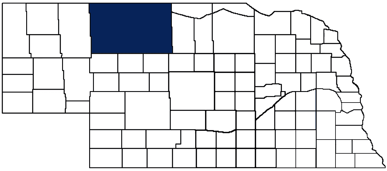
- General Info
- Demographics
- Education and Employment
- Valuation and Taxes Levied
- State Senators
- History
- County Programs
- Other Information
Communities & Development
Cherry County Seat: Valentine
Total County Population: 5,561
- Cities (pop. & class): Valentine (2,635 • 2nd Class)
- Villages (pop.): Cody (171), Crookston (75), Kilgore (68), Merriman (91), Nenzel (18), Wood Lake (50)
- Unincorporated Pop. (% of county pop.): 2,453 (44%) 2025
Land Development (% of total land in county):
- Agriculture: 92%
- By method: Pasture (pure grassland) (91%); Irrigated (row crop/grain/forage) (2%); Dryland (row crop/grain/forage) (0%) • Neb. Dept. of Rev. - total equals agriculture's %
- By commodity: Livestock (grassland) 89%, Corn 1% • USDA (NLCD) - equals agriculture's % plus some wetlands (8%) and minus public grassland/wetlands and reserve
- Residential, Commercial, Industrial, Conservation Reserve & Exempt (combined): 8% 2022
County Offices
Courthouse Address and Hours:
365 North Main Street
Valentine, Nebraska 69201
M-F 8:30 am - 4:30 pm
Complete list of county board members
County Board Meetings: 2nd & Last Tuesday
View the County's Government Maps
NACO District: West Central
West Central District Officers
General
Population: 5,561
Land area (sq. mi.): 5,960.22
Population per square mile: 0.9
Race & Age
Race 2024
White: 83.8%
African American: 1.0%
American Indian: 5.2%
Asian: 1.7%
Hispanic: 3.5%
Native Hawaiian and Pacific Islander: 0.0%
Two or More Races: 3.9%
Age 2024
0-17: 23.4%
18-64: 54.7%
65+: 22.1%
Households
Total households: 2,233 2023
With one child: 220 2023
With 2+ children: 330 2023
With seniors (65+): 370 2023
Socioeconomics
Median household income: $66,270 2024
% of Population in Poverty: 10.2% 2024
# of Housing Units: 3,009 2024
Owner-occupied rate: 65.1% 2024
Median home price: $158,480 Q4 2025
2025 building permits for detached single family homes: 16
2025 building permits for non-detached housing units: 42 (townhouse, duplex, or apt. unit)
Technology
Access to broadband (100 Mbps via fiber or cable modem): 77.9% 2025
Sources: National Association of Realtors, Nebraska Department of Revenue, Nebraska Legislature, Nebraska Library Commission, U.S. Bureau of Economic Analysis, U.S. Census Bureau (building permits), U.S. Census Bureau (demographics), U.S. Census Bureau (municipalities)
Employment, Schools, and Child Care
Unemployment rate: 2.4% February 2026
County Employment Website: https://cherrycountyne.gov/webpages/links/public_notices.html
High school graduate or higher: 96.2% 2024
School Districts: Cody-Kilgore Public Schools, Gordon-Rushville Public Schools, Hyannis Area Schools, Mullen Public Schools, Thedford Public Schools, Valentine Community Schools
Bachelor's degree or higher: 25.3% 2024
Community College Service Areas: Mid-Plains Community College, Western Community College
Countywide child care capacity: 10 providers; 116 children 2026
Find child care: For a list of child care providers in your zip code, visit Nebraska DHHS or the Nebraska Resource and Referral System.
Cherry County Economy
Annual Gross Domestic Product (GDP): $484,893,000 2024
Nonfarm Small Business Receipts: $363,504,931 2023
Nonfarm Wage Income: $92,670,000 2022
Farm and Ranch Commodity Sales Receipts: $270,939,000 2022
Farm and Ranch Operations (Non-Sales) Receipts: $9,558,000 2022
- For components of nonfarm small business receipts, nonfarm wage income, and farm & ranch commodity sales and operations receipts, see "Notes" below.
Local Grain Market: Click for today's grain prices in Cherry County
Cattle Producers: 404
- Pastureland Cash Rent (avg.): $16/acre 2025
Crop Producers: 121
Farmers Market: Valentine Area Farmers Market - IGA ( August - October, Saturdays 9 a.m. - 1 p.m.)
Electricity Providers: Cherry-Todd Electric Coop., City of Valentine, Custer PPD, KBR Rural PPD, Lacreek Electric Association, Inc., Nebraska PPD, Northwest Rural PPD, PREMA
Notes
- Nonfarm small business receipts are reported by partnerships and sole proprietorships. They do not include receipts reported by cooperative associations.
- Nonfarm wage income is reported based upon the wage earner's residential address; therefore, it also includes wages earned by Cherry County residents in other counties or states, but it excludes wages earned in Cherry County by residents of other counties or states.
- Nonfarm wage income excludes wages earned by anyone claimed as a dependent.
- Farm and ranch commodity sales receipts and operations receipts are reported based upon the farm or ranch owner's principal county of operations; therefore, those figures also include receipts reported by producers operating principally in Cherry County for their production in other counties or states, but the figures exclude receipts reported for production in Cherry County by producers operating principally in other counties or states.
Irrigation, Drinking Water, and Soils
Rural Irrigation/Livestock Wells: 4,016 2026
Rural Commercial/Industrial Wells: 2 2025
Rural Drinking Water Wells: 471 2025
Drinking Water Utility Connections: 1,412 Residential; 295 Commercial; 0 Industrial 2024
Agricultural Wells per Square Mile: 0.67 2026
Surface Water Diversions (Irrigation): 154 2024
Click for real time:
Streamflow data on the Niobrara River near Berry Falls (SW of Sparks)
Groundwater level data east of Cottonwood/Stevenson WMA
Groundwater level data near U.S. Hwy 83 and Loup River Road
Groundwater level data west of Bristol Lake
Sources: National Agricultural Statistics Service (USDA), Nebraska Cooperative Council, Nebraska Coordinating Commission for Postsecondary Education, Nebraska Department of Health and Human Services, Nebraska Department of Revenue, Nebraska Department of Transportation, Nebraska Office of the CIO, Nebraska Power Review Board, Nebraska Public Service Commission, U.S. Bureau of Economic Analysis, U.S. Bureau of Labor Statistics, U.S. Census Bureau, U.S. Energy Information Administration, U.S. Department of the Treasury (IRS), Warehouse and Commodity Management Division (USDA)
2024 Levies and Valuations
County levy rate: $0.159 per $100 of taxable valuation
County property taxes levied: $4,873,771
Total local government property taxes levied: $23,574,181
Total countywide taxable valuation: $3,059,475,422
Federal PILT payment to Cherry County (FY2025): $402,928 regarding 140,633 federally-owned acres
Federal SRS payment to Cherry County (FY 2025): $69,240.50 regarding the Samuel R. McKelvie National Forest
Click here for all levy rates in Cherry County
County Levy and Taxation Laws
Levy limits
Since 1996, counties and other political subdivisions have been subject to the levy limits listed in Neb. Rev. Stat. § 77-3442 and Neb. Rev. Stat. § 77-3443.
Statutes and regulations
Nebraska Revised Statutes (Chapter 77)
Nebraska Administrative Code (Title 350)
Local tax reductions, exemptions, and credits:
Neb. Rev. Stat. § 76-902(5)(a) (Deed "stamp tax" exemption): "The [stamp tax] shall not apply to: ... (5)(a) Deeds between spouses, between ex-spouses for the purpose of conveying any rights to property acquired or held during the marriage, or between parent and child, without actual consideration therefor."
Neb. Rev. Stat. § 77-201(2) (Valuation of agricultural land and horticultural land): "Agricultural land and horticultural land as defined in section 77-1359 shall constitute a separate and distinct class of property for purposes of property taxation, shall be subject to taxation, unless expressly exempt from taxation, and shall be valued at seventy-five percent of its actual value, except that for school district taxes levied to pay the principal and interest on bonds that are approved by a vote of the people on or after January 1, 2022, such land shall be valued at fifty percent of its actual value."
Neb. Rev. Stat. § 77-6703(1) (Tax credit for school district taxes paid): "(1) For taxable years beginning or deemed to begin on or after January 1, 2020, under the Internal Revenue Code of 1986, as amended, there shall be allowed to each eligible taxpayer a refundable credit against the income tax imposed by the Nebraska Revenue Act of 1967 or against the franchise tax imposed by sections 77-3801 to 77-3807. The credit shall be equal to the credit percentage for the taxable year, as set by the department under subsection (2) of this section, multiplied by the amount of school district taxes paid by the eligible taxpayer during such taxable year."
Sources: Nebraska Department of Revenue
State Senator: Tanya Storer (District 43)
Committees:
Map and statistics for Legislative District 43
Map of all districts in the Nebraska Unicameral Legislature

Cherry County History
Number of Registered Historic Places: 12
Year Authorized: 1883
Year Organized: 1883
Etymology: Samuel Cherry (U.S. Army Lieutenant)
Cherry County covers over 6,000 square miles, making it the largest county in the state (and the 65th largest county equivalent in the United States in terms of land area). The county is known for its diverse geography, which ranges from rolling prairies to rugged canyons, as well as its rich history and cultural heritage.
Originally, Cherry County was inhabited by several Native American tribes, including the Sioux, Pawnee, and Cheyenne. In the late 1800s, settlers began to arrive in the area and the U.S. government forced the Native Americans to move to reservations. The arrival of the settlers led to significant changes in the area, including the introduction of new industries, such as ranching and agriculture. The county's soil and water sources have made it a major center for agriculture, including crops corn, wheat, and soybeans being grown in the area.
One of the most important historical events in Cherry County's history was the establishment of Fort Niobrara in 1880. The fort was established to protect the settlers from raids by Sioux warriors and to serve as a base for U.S. troops to patrol the area. The fort was also used as a supply depot for settlers, as well as a center for military operations in the region. Today, Fort Niobrara is a National Wildlife Refuge, offering visitors a glimpse into the history of the region and the important role it played in the development of the American West.
The construction of the Valentine & Niobrara Railroad was another important local event in Cherry County. The railroad was completed in 1886 and helped spur economic growth in the area by connecting Valentine to the rest of the state.
When the county was formally organized in 1883, the residents opted to name it for Samuel D. Cherry, a U.S. Fifth Cavalry Lieutenant who had been killed two years earlier. Lieutenant Cherry had been leading a military patrol in pursuit of suspected robbers when one of his soldiers (who was heavily intoxicated) shot and killed him.
The vast space of Cherry County abounds in natural resources. The area is home to several canyons, including the Niobrara River Canyon and Smith Falls Canyon, which are popular tourist destinations. Cherry County also offers visitors the chance to see the largest waterfalls in Nebraska (Snake River Falls in terms of volume, Smith Falls terms of sheer drop). The county is also home to the Fort Niobrara National Wildlife Refuge, which showcases a variety of wildlife, including bison, elk, and pronghorn antelope.
Highlight an important program in your county in this space! Send an email to:
Local Highlights
License Plate Number: 66
Number of Veterans: 294 2026
Zoned County: Yes
Number of County-Owned Bridges: 45
Time Zones: Central & Mountain
- Boundary line: The boundary line between the central and mountain time zones runs along the western boundaries of Crookston, Valentine, Cleveland, and Loup precincts in Cherry County, or approximately 12-18 miles west of U.S. Hwy 83 along various section lines in PLSS Range 30.
- History of boundary line:
- April 6, 1948: Northeastern Cherry County citizens vote to use central standard time. It is possible that the concentration of grain producers in that part of the county north of the Niobrara River, as opposed to the larger predominance of cattle and hay producers in other parts of the county, led residents there to prefer being in the same time zone as other grain producing areas along the Niobrara River to the east.
- August 9, 1967: The Nebraska Legislature and Governor petition the federal government to move northeastern Cherry County from central standard time to mountain standard time, among other changes in central Nebraska. Federal Register, Vol. 32, No. 153
- November 9, 1968: Northeastern Cherry County citizens vote 910 to 303 to return to central standard time.
- March 5, 1969: Northeastern Cherry County citizens petition the federal government to return them to central standard time. Federal Register, Vol. 34, No. 43
- May 23, 1969: The federal government places all of eastern Cherry County into central standard time (effective June 29, 1969). Federal Register, Vol. 34, No. 99
- Aug. 1, 1970: Recodification of all standard time zones as 49 CFR § 71.7, which remains the regulation today. Federal Register, Vol. 35, No. 149
Election Data
General Election Turnout: 84% 2024
Total Registered Voters: 3,651 2024
Number of Precincts: 10 2024
Number of Election Day Polling Places: All Voting by Mail
Intergovernmental Data
Emergency Mgt. Planning, Exercise and Training (PET) Region: North Central/Sandhills
Natural Resource Districts: Middle Niobrara NRD, Upper Loup NRD
State Lands (acres): Anderson Bridge WMA (137), Ballards Marsh WMA (1,561.50), Big Alkali Lake WMA (889.40), Borman Bridge WMA (159.10), Chat Caynon WMA (437.57), Cottonwood Lake SRA (240), Cottonwood/Steverson WMA (2,902), Government Canyon Valentine Fish Hatchery (698), Merritt Reservoir WMA (8,962) Rat and Beaver Lake WMA (242.70), Schlagel Creek WMA (610), Shell Lake WMA (380), Smith Falls State Park (265.50)
Federal Lands (acres): Fort Niobrara National Wildlife Refuge (19,131), Samuel R. McKelvie National Forest (114,722), Valentine National Wildlife Refuge (71,516)
Sources: Nebraska Department of Transportation, Nebraska Emergency Management Agency, Nebraska Game & Parks Commission, Nebraska Legislature, Nebraska Office of the CIO, Nebraska Secretary of State, U.S. Department of Veterans Affairs, U.S. Election Assistance Commission, U.S. National Archives and Records Administration (eCFR)