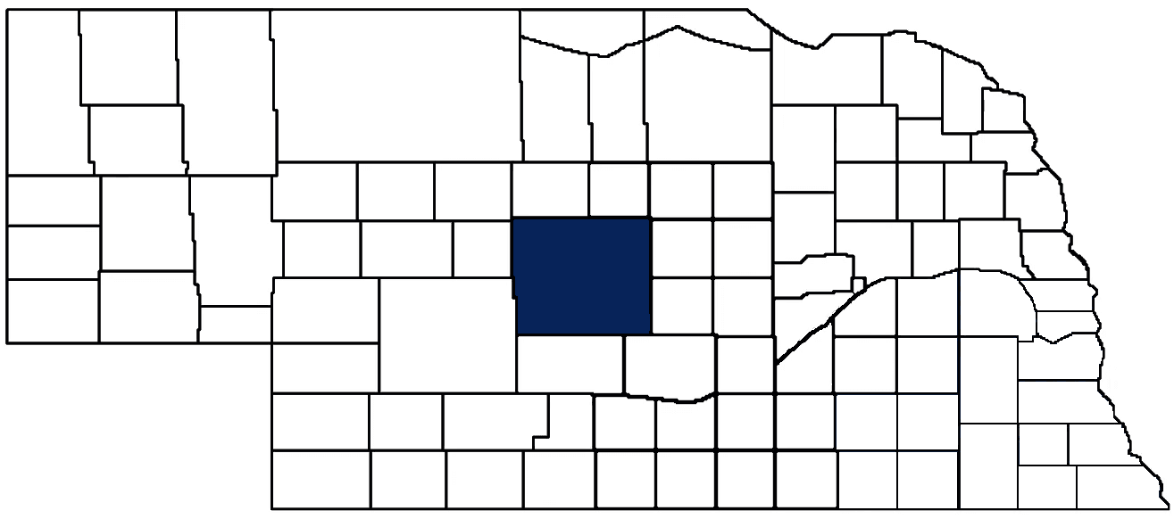
- General Info
- Demographics
- Education and Employment
- Valuation and Taxes Levied
- State Senators
- History
- County Programs
- Other Information
Communities & Development
Custer County Seat: Broken Bow
Total County Population: 10,500
- Cities (pop. & class): Broken Bow (3,507 • 2nd Class), Sargent (480 • 2nd Class)
- Villages (pop.): Anselmo (106), Ansley (456), Arnold (591), Berwyn (73), Callaway (561), Comstock (73), Mason City (149), Merna (344), Oconto (141)
- Unincorporated Pop. (% of county pop.): 4,019 (38%) 2025
Land Development (% of total land in county):
- Agriculture: 97%
- By method: Pasture (pure grassland) (71%); Irrigated (row crop/grain/forage) (17%); Dryland (row crop/grain/forage) (9%) • Neb. Dept. of Rev. - total equals agriculture's %
- By commodity: Livestock (grassland) 69%, Corn 15%, Soybeans 6%, Alfalfa 3%, Sorghum 1% • USDA - equals agriculture's % plus some wetlands (1%) and minus public grassland/wetlands and reserve
- Residential, Commercial, Industrial, Conservation Reserve & Exempt (combined): 3% 2022
County Offices
Courthouse Address and Hours:
431 South 10th Street
Broken Bow, Nebraska 68822
M-F 9:00 am - 5:00 pm
Complete list of county board members
County Board Meetings: 2nd & 4th Tuesday
View the County's Government Maps
NACO District: Central
General
Population: 10,500
Land area (sq. mi.): 2,575.59
Population per square mile: 4.1
Race & Age
Race 2024
White: 91.6%
African American: 0.5%
American Indian: 0.4%
Asian: 0.1%
Hispanic: 4.0%
Native Hawaiian and Pacific Islander: 0.2%
Native Hawaiian and Pacific Islander: 2.7%
Age 2024
0-17: 24.3%
18-64: 53.0%
65+: 22.6%
Households
Total households: 4,502 2024
With one child: 480 2023
With 2+ children: 760 2023
With seniors (65+): 670 2023
Socioeconomics
Median household income: $67,906 2024
% of Population in Poverty: 11.5% 2024
# of Housing Units: 5,334 2024
Owner-occupied rate: 72.7% 2024
Median home price: $164,310 Q4 2025
2024 building permits for detached single family homes: 20
2024 building permits for non-detached housing units: 4 (townhouse, duplex, or apt. unit)
Technology
Access to broadband (100 Mbps via fiber or cable modem): 85.9% 2025
Sources: National Association of Realtors, Nebraska Department of Revenue, Nebraska Legislature, Nebraska Library Commission, U.S. Bureau of Economic Analysis, U.S. Census Bureau (building permits), U.S. Census Bureau (demographics), U.S. Census Bureau (municipalities)
Employment, Schools, and Child Care
Unemployment rate: 2.9% February 2026
County Employment Website: https://custercountyne.gov/webpages/links/public_notices.html
High school graduate or higher: 95.0% 2024
School Districts: Anselmo-Merna Public Schools, Ansley Public Schools, Arnold Public Schools, Arcadia Public Schools, Broken Bow Public Schools, Callaway Public Schools, Cozad Community Schools, Gothenburg Public Schools, Litchfield Public Schools, Loup County Public Schools, Ord Public Schools, Sandhills Public Schools, Sargent Public Schools, Sumner-Eddyville-Miller Schools
Bachelor's degree or higher: 24.3% 2024
Community College Service Area: Mid-Plains Community College
Countywide child care capacity: 17 providers; 448 children 2026
Find child care: For a list of child care providers in your zip code, visit Nebraska DHHS or the Nebraska Resource and Referral System.
Custer County Employment
Annual Gross Domestic Product (GDP): $882,262,000 2024
Nonfarm Small Business Receipts: $125,989,699 2023
Nonfarm Wage Income: $208,987,000 2022
Farm and Ranch Commodity Sales Receipts: $993,880,000 2022
Farm and Ranch Operations (Non-Sales) Receipts: $33,469,000 2022
- For components of nonfarm small business receipts, nonfarm wage income, and farm & ranch commodity sales and operations receipts, see "Notes" below.
Grain Elevators by Location (bushels capacity):
- Anselmo: Country Partners (5,337,570), The Andersons (4,946,002)
- Ansley: Trotter (43,411)
- Callaway: Seven Valleys Grain (2,037,177)
- Merna: Country Partners (2,906,927)
- Sargent: Trotter (1,959,478)
- (1 bushel = 56 lbs. corn/sorghum, 60 lbs. soybeans/wheat; % max. moisture = 18% beans, 15.5% corn, 14% sorghum/soybeans, 13.5% wheat)
Railroad Miles: 107.75 main, 6.44 side
- Places with Railroad Service: Anselmo, Ansley, Berwyn, Broken Bow, Mason City
Farmers Market: Market on the Square (Broken Bow) (May 19 - September 8, Thursdays 10 a.m. - 3 p.m.)
Local Grain Market: Click for today's grain prices in Custer County
Cattle Producers: 635
- Pastureland Cash Rent (avg.): $36/acre 2025
Crop Producers: 465
- Dryland Cash Rent (avg.): $98/acre 2025
- Irrigated Land Cash Rent (avg.): $246/acre 2025
Dairy Producers: 2
Electricity Providers: City of Ansley, City of Broken Bow, City of Sargent, Custer PPD, Dawson PPD, Loup Valleys Rural PPD, Village of Arnold, Village of Callaway
Wind Turbines Operating (MW): 93 turbines (153,100 MW)
Notes
- Nonfarm small business receipts are reported by partnerships and sole proprietorships. They do not include receipts reported by cooperative associations.
- Nonfarm wage income is reported based upon the wage earner's residential address; therefore, it also includes wages earned by Custer County residents in other counties or states, but it excludes wages earned in Custer County by residents of other counties or states.
- Nonfarm wage income excludes wages earned by anyone claimed as a dependent.
- Farm and ranch commodity sales receipts and operations receipts are reported based upon the farm or ranch owner's principal county of operations; therefore, those figures also include receipts reported by producers operating principally in Custer County for their production in other counties or states, but the figures exclude receipts reported for production in Custer County by producers operating principally in other counties or states.
Irrigation, Drinking Water, and Soils
Rural Irrigation/Livestock Wells: 3,267 2026
Rural Commercial/Industrial Wells: 29 2026
Rural Drinking Water Wells: 615 2026
Drinking Water Utility Connections: 3,166 Residential; 399 Commercial; 7 Industrial 2024
Agricultural Wells per Square Mile: 1.27 2026
Surface Water Diversions (Irrigation): 140 2024
Click for real time:
Streamflow data on the Middle Loup River (15 mi. northeast of Anselmo)
Streamflow data on the South Loup River at Arnold
Streamflow data on the South Loup River at Pressey WMA (17 mi. southeast of Callaway)
Sources: National Agricultural Statistics Service (USDA), Nebraska Cooperative Council, Nebraska Coordinating Commission for Postsecondary Education, Nebraska Department of Health and Human Services, Nebraska Department of Revenue, Nebraska Department of Transportation, Nebraska Office of the CIO, Nebraska Power Review Board, Nebraska Public Service Commission, U.S. Bureau of Economic Analysis, U.S. Bureau of Labor Statistics, U.S. Census Bureau, U.S. Energy Information Administration, U.S. Department of the Treasury (IRS), Warehouse and Commodity Management Division (USDA)
2025 Levies and Valuations
County levy rate: $0.210 per $100 of taxable valuation
County property taxes levied: $8,145,976
Total local government property taxes levied: $44,698,785
Total countywide taxable valuation: $3,873,477,362
Click here for all levy rates in Custer County
County Levy and Taxation Laws
Levy limits
Since 1996, counties and other political subdivisions have been subject to the levy limits under Neb. Rev. Stat. § 77-3442 and Neb. Rev. Stat. § 77-3443.
Statutes and regulations:
Nebraska Revised Statutes (Chapter 77)
Nebraska Administrative Code (Title 350)
Local tax reductions, exemptions, and credits:
Neb. Rev. Stat. § 76-902(5)(a) (Deed "stamp tax" exemption): "The [stamp tax] shall not apply to: ... (5)(a) Deeds between spouses, between ex-spouses for the purpose of conveying any rights to property acquired or held during the marriage, or between parent and child, without actual consideration therefor."
Neb. Rev. Stat. § 77-201(2) (Valuation of agricultural land and horticultural land): "Agricultural land and horticultural land as defined in section 77-1359 shall constitute a separate and distinct class of property for purposes of property taxation, shall be subject to taxation, unless expressly exempt from taxation, and shall be valued at seventy-five percent of its actual value, except that for school district taxes levied to pay the principal and interest on bonds that are approved by a vote of the people on or after January 1, 2022, such land shall be valued at fifty percent of its actual value."
Neb. Rev. Stat. § 77-6703(1) (Tax credit for school district taxes paid): "(1) For taxable years beginning or deemed to begin on or after January 1, 2020, under the Internal Revenue Code of 1986, as amended, there shall be allowed to each eligible taxpayer a refundable credit against the income tax imposed by the Nebraska Revenue Act of 1967 or against the franchise tax imposed by sections 77-3801 to 77-3807. The credit shall be equal to the credit percentage for the taxable year, as set by the department under subsection (2) of this section, multiplied by the amount of school district taxes paid by the eligible taxpayer during such taxable year."
Sources: Nebraska Department of Revenue
State Senator: Tanya Storer (District 43)
Committees
Map and statistics for Legislative District 43
Map of all districts in the Nebraska Unicameral Legislature

Custer County History
Number of Registered Historic Places: 14
Year Authorized: 1877
Year Organized: 1877
Etymology: George Custer (U.S. Army General)
Located in the geographic heart of the state, Custer County features a diverse blend of topography. Nearly three-quarters of the county is in the state's corn belt, while the northwest one-quarter is considered part of the Sandhills. Consequently, corn and cattle production are the dominant contributors to the county's present day economy.
The organization of Custer County was officially approved on Feb. 17, 1877. This came after a group of 13 ranchers and settlers sent to the governor a signed petition asking that the territory be formed into a governmental body. The county was named in honor of Gen. George A. Custer, who was killed the preceding summer.
Only a handful of settlers came to the area in the years leading up to the 1870s. Since the region was virtually uninhabited, these settlers were able to amass enormous ranches. Eventually, more and more homesteaders came to the area, fenced in their land, and planted crops. With the tremendous cattle losses during the winter of 1880-81, the ranchers gave way to thousands of homesteaders coming to the area after the Civil War. Sod houses and small settlements quickly began to replace the vast ranches.
The first courthouse was a cedar log, two-room, L-shaped structure that was built in 1876 on the Young Ranch near the South Loup River. It was used from the time the county was organized in 1877 until Broken Bow was named the county seat after a special three-way election.
People often inquire how the county seat received its unique name. According to historians, Wilson Hewitt was postmaster for the area at the time and had suggested three names. Shortly after the third was rejected, Hewitt's two sons showed him a broken Indian bow they had found on the banks of nearby Muddy Creek. Hewitt suggested Broken Bow and it was quickly accepted by the post office department.
A red brick, ornate courthouse with rounded towers on the corners was build in 1889. It was destroyed by fire in 1910. Two years later, the county's present courthouse was constructed on the same site.
Highlight an important program in your county in this space! Send an email to:
Local Highlights
License Plate Number: 4
Time Zone: Central
Number of Veterans: 622 2026
Zoned County: Yes
Number of County-Owned Bridges: 245
Number of County-Owned Dams: 2
Election Data
General Election Turnout: 77% 2024
Total Registered Voters: 7,671 2024
Number of Precincts: 18 2024
Number of Election Day Polling Places: 11 2024
Land Area per Polling Place (avg.): 234.14 sq. miles
Intergovernmental Data
Emergency Mgt. Planning, Exercise and Training (PET) Region: North Central/Sandhills
Natural Resource Districts: Lower Loup NRD, Central Platte NRD
State Lands (acres): Arcadia Diversion Dam WMA (882.30), Berggren-Young WMA (160), Myrtle E. Hall WMA (1,960 Custer & Loup), Pressey WMA (1,578.60), Victoria Springs SRA (60)
Sources: Nebraska Department of Transportation, Nebraska Emergency Management Agency, Nebraska Game & Parks Commission, Nebraska Legislature, Nebraska Office of the CIO, Nebraska Secretary of State, U.S. Department of Veterans Affairs, U.S. Election Assistance Commission, U.S. National Archives and Records Administration (eCFR)