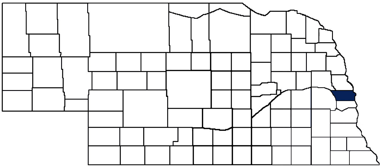
- General Info
- Demographics
- Education and Employment
- Valuation and Taxes Levied
- State Senators
- History
- County Programs
- Other Information
Communities & Development
Douglas County Seat: Omaha
Total County Population: 606,406
- Cities (pop. & class): Bennington (1,968 • 2nd Class), Omaha (488,797 • Metropolitan Class), Ralston (6,382 • 2nd Class), Valley (3,412 • 2nd Class)
- Villages (pop.): Boys Town (616), Waterloo (917)
- Unincorporated Pop. (% of county pop.): 104,314 (15%) 2025
Land Development and Usage (% of total county land area):
- Agriculture: 31%
- By method: Dryland (row crop/grain/forage) (20%); Pasture (pure grassland) (6%); Irrigated (row crop/grain/forage) (6%)
- By commodity: Corn 15%, Soybeans 12%, Livestock (grassland) 10%, Alfalfa 1% • USDA - equals agriculture's % plus some wetlands (1%) and minus public grassland/wetlands and reserve
- Residential, Commercial, Industrial, Conservation Reserve & Exempt (combined): 69% 2022
County Offices
Courthouse Address and Hours:
Civic Center
1819 Farnam Street
Omaha, Nebraska 68183
M-F 7:30 am - 5:00 pm
Complete list of county board members
County Board Meetings: Every Tuesday
View the County's Government Maps (redirects to loading page)
NACO District: Southeast
Click for a live look at Douglas County (I-480 at the Missouri River Bridge)
General
Population: 606,460
Land area (sq. mi.): 326.41
Population per square mile: 1,858.0
Race & Age
Race 2024
White: 65.8%
African American: 10.2%
American Indian: 0.2%
Asian: 4.4%
Hispanic: 14.5%
Native Hawaiian and Pacific Islander: 0.0%
Two or More Races: 4.5%
Age 2020
0-17: 25.3%
18-64: 61.6%
65+: 13.7%
Households
Total households: 238,430 2024
With one child: 32,870 2023
With 2+ children: 43,810 2023
With seniors (65+): 28,720 2023
Socioeconomics
Median household income: $80,391 2024
% of Population in Poverty: 11.8% 2024
# of Housing Units: 251,553 2024
Owner-occupied rate: 59.8% 2020
Median home price: $300,310 Q4 2025
2024 building permits for detached single family homes: 1,744
2024 building permits for non-detached housing units: 0 (townhouse, duplex, or apt. unit)
Technology
Access to broadband (100 Mbps via fiber or cable modem): 98.3% 2025
Sources: National Association of Realtors, Nebraska Library Commission, U.S. Bureau of Economic Analysis, U.S. Census Bureau
Employment, Schools, and Child Care
Unemployment rate: 3.6% February 2026
County Employment Website: https://hr.douglascounty-ne.gov/employment
High school graduate or higher: 91.4% 2024
School Districts: Arlington Public Schools, Bennington Public Schools, Douglas County West Community Schools, Elkhorn Public Schools, Fort Calhoun Community Schools, Fremont Public Schools, Gretna Public Schools, Millard Public Schools, Omaha Public Schools, Ralston Public Schools, Westside Community Schools
Bachelor's degree or higher: 42.1% 2024
Community College Service Area: Metropolitan Community College
County child care capacity: 750 providers; 51,777 children 2026
Find child care: For a list of child care providers in your zip code, visit Nebraska DHHS or the Nebraska Resource and Referral System.
Douglas County Economy
Annual Gross Domestic Product (GDP): $73,770,708,000 2024
Nonfarm Small Business Receipts: $13,574,061,676 2023
Nonfarm Wage Income: $18,039,018,000 2022
Farm and Ranch Commodity Sales Receipts: $58,610,000 2022
Farm and Ranch Operations (Non-Sales) Receipts: $3,859,000 2022
- For components of nonfarm small business receipts, nonfarm wage income, and farm & ranch commodity sales and operations receipts, see "Notes" below.
Grain Elevators by Location (bushels capacity):
- Omaha: West Plains (847,000)
- (1 bushel = 56 lbs. corn/sorghum, 60 lbs. soybeans/wheat; % max. moisture = 18% beans, 15.5% corn, 14% sorghum/soybeans, 13.5% wheat)
Railroad Miles: 94.62 main, 128.44 side
- Places with Railroad Service: Elkhorn, Omaha, Ralston, Valley, Waterloo
Cattle Producers: 41
Crop Producers: 59
- Dryland Cash Rent (avg.): $234/acre 2025
- Irrigated Land Cash Rent (avg.): $283/acre 2025
Dairy Producers: 1
Farmers Markets:
- Florence Mill Farmers Market (Omaha) (June - September, Sundays 10 AM - 3 PM)
- Gifford Park Neighborhood Market (Omaha) (June - September, Fridays 5 - 8 PM)
- Omaha Farmers Market in Aksarben Village (May - October, Sundays 9 AM - 1 PM (1st hour for seniors and those with underlying health issues))
- Omaha Farmers Market in the Old Market (May - October, Saturdays 8 AM - 12:30 PM (1st hour for seniors & people with underlying health issues))
- Omaha Night Market (May - September, Last Friday of the Month, 6 - 10 PM)
- Sunday Garden Mart (Omaha) (June - September, Sundays 9 AM - 12 PM (Goodwill donations only, proceeds go toward hunger relief))
- Village Pointe Farmers Market (May - October, Saturdays 8:30 AM - 12:30 PM)
Local Grain Market: Click for today's grain prices in Douglas County
Electricity Providers: Omaha PPD
Notes
- Nonfarm small business receipts are reported by partnerships and sole proprietorships. They do not include receipts reported by cooperative associations.
- Nonfarm wage income is reported based upon the wage earner's residential address; therefore, it also includes wages earned by Douglas County residents in other counties or states, but it excludes wages earned in Douglas County by residents of other counties or states.
- Nonfarm wage income excludes wages earned by anyone claimed as a dependent.
- Farm and ranch commodity sales receipts and operations receipts are reported based upon the farm or ranch owner's principal county of operations; therefore, those figures also include receipts reported by producers operating principally in Douglas County for their production in other counties or states, but the figures exclude receipts reported for production in Douglas County by producers operating principally in other counties or states.
Irrigation, Drinking Water, and Soils
Rural Irrigation/Livestock Wells: 395 2026
Rural Commercial/Industrial Wells: 52 2026
Rural Drinking Water Wells: 787 2024
Drinking Water Utility Connections: 203,483 Residential; 20,195 Commercial; 78 Industrial 2024
Agricultural Wells per Square Mile: 1.21 2026
Surface Water Diversions (Irrigation): 56 2024
Click for real time:
Streamflow data on the Missouri River at Omaha
Streamflow data on Big Papillion Creek near Bennington
Streamflow data on Big Papillion Creek at Fort Street in Omaha
Streamflow data on Little Papillion Creek at Irvington
Streamflow data on Little Papillion Creek at Ak-Sar-Ben in Omaha
Streamflow data on Big Papillion Creek at Q Street in Omaha
Streamflow data on West Papillion Creek at Millard
Streamflow data on the Platte River near Leshara
Streamflow data on the Elkhorn River at Waterloo
Sources: National Agricultural Statistics Service (USDA), Nebraska Cooperative Council, Nebraska Coordinating Commission for Postsecondary Education, Nebraska Department of Health and Human Services, Nebraska Department of Revenue, Nebraska Department of Transportation, Nebraska Office of the CIO, Nebraska Power Review Board, Nebraska Public Service Commission, U.S. Bureau of Economic Analysis, U.S. Bureau of Labor Statistics, U.S. Census Bureau, U.S. Energy Information Administration, U.S. Department of the Treasury (IRS), Warehouse and Commodity Management Division (USDA)
2024 Levies and Valuation
County levy rate: $0.291 per $100 of taxable valuation
County property taxes levied: $216,193,165
Total local government property taxes levied: $1,516,331,191
Total countywide taxable valuation: $74,397,994,050
Federal PILT payment to Douglas County (FY2024): $10,440 regarding 3,019 federally-owned acres
Click here for all levy rates in Douglas County
County Levy and Taxation Laws
Levy limits
Since 1996, counties and other political subdivisions have been subject to levy limits under Neb. Rev. Stat. § 77-3442 and Neb. Rev. Stat. § 77-3443.
Statutes and regulations
Nebraska Revised Statutes (Chapter 77)
Nebraska Administrative Code (Title 350)
Local tax reductions, exemptions, and credits:
Neb. Rev. Stat. § 76-902(5)(a) (Deed "stamp tax" exemption): "The [stamp tax] shall not apply to: ... (5)(a) Deeds between spouses, between ex-spouses for the purpose of conveying any rights to property acquired or held during the marriage, or between parent and child, without actual consideration therefor."
Neb. Rev. Stat. § 77-201(2) (Valuation of agricultural land and horticultural land): "Agricultural land and horticultural land as defined in section 77-1359 shall constitute a separate and distinct class of property for purposes of property taxation, shall be subject to taxation, unless expressly exempt from taxation, and shall be valued at seventy-five percent of its actual value, except that for school district taxes levied to pay the principal and interest on bonds that are approved by a vote of the people on or after January 1, 2022, such land shall be valued at fifty percent of its actual value."
Neb. Rev. Stat. § 77-6703(1) (Tax credit for school district taxes paid): "(1) For taxable years beginning or deemed to begin on or after January 1, 2020, under the Internal Revenue Code of 1986, as amended, there shall be allowed to each eligible taxpayer a refundable credit against the income tax imposed by the Nebraska Revenue Act of 1967 or against the franchise tax imposed by sections 77-3801 to 77-3807. The credit shall be equal to the credit percentage for the taxable year, as set by the department under subsection (2) of this section, multiplied by the amount of school district taxes paid by the eligible taxpayer during such taxable year."
Sources: Nebraska Department of Revenue
State Senator: Victor Rountree (District 3)
Committees:
- General Affairs
- Judiciary
- Urban Affairs
- State-Tribal Relations
- Justice Reinvestment Oversight (LB605)
Map and statistics for Legislative District 3
State Senator: R. Brad Von Gillern (District 4)
Committees:
- Banking, Commerce and Insurance
- Revenue
- Statewide Tourism And Recreational Water Access and Resource Sustainability (LB406)
Map and statistics for Legislative District 4
State Senator: Machaela Cavanaugh (District 6)
Committees:
- Appropriations
- Legislative Performance Audit
Map and statistics for Legislative District 6
State Senator-Elect: Tim C. Pendrell (District 7)
State Senator: Dunixi Guereca (District 7)
Committees:
- Government, Military and Veterans Affairs
- Transportation and Telecommunications
- Enrollment and Review
- State-Tribal Relations
Map and statistics for Legislative District 7
State Senator: Megan Hunt (District 8)
Committees:
- Education
- Government, Military and Veterans Affairs
- Committee On Committees
- State-Tribal Relations
Map and statistics for Legislative District 8
State Senator: John Cavanaugh (District 9)
Committees:
- General Affairs
- Government, Military and Veterans Affairs
- Urban Affairs
- Committee On Committees
- Midwestern Higher Education Compact Commission
- Justice Reinvestment Oversight (LB605)
Map and statistics for Legislative District 9
State Senator: Wendy DeBoer (District 10)
Committees:
- Judiciary
- Transportation and Telecommunications
- Rules
- Legislature's Planning Committee
- Nebraska Information Technology Commission
Map and statistics for Legislative District 10
State Senator: Terrell McKinney (District 11)
Committees:
- Business and Labor
- Judiciary
- Urban Affairs
- Reference
- Executive Board
Map and statistics for Legislative District 11
State Senator: Merv Riepe (District 12)
Committees:
- Banking, Commerce and Insurance
- Health and Human Services
- Legislative Performance Audit
- Legislature's Planning Committee
Map and statistics for Legislative District 12
State Senator: Ashlei Spivey (District 13)
Committees:
- Appropriations
- Committee On Committees
- State-Tribal Relations
Map and statistics for Legislative District 13
State Senator: Dave "Woody Wordekemper (District 15)
Committees:
- Banking, Commerce and Insurance
- Government, Military and Veterans Affairs
- Building Maintenance
Map and statistics for Legislative District 15
State Senator: Christy Armendariz (District 18)
Committees:
- Appropriations
- Committee On Committees
Map and statistics for Legislative District 18
State Senator: John Fredrickson (District 20)
Committees:
- Health and Human Services
- Transportation and Telecommunications
- Committee On Committees
- Reference
- Executive Board
Map and statistics for Legislative District 20
State Senator: Kathleen Kauth (District 31)
Committees:
Map and statistics for Legislative District 31
State Senator: Rick Holdcroft (District 36)
Committees:
- Agriculture
- General Affairs
- Judiciary
- Legislature's Planning Committee
- Justice Reinvestment Oversight (LB605)
- Statewide Tourism And Recreational Water Access and Resource Sustainability (LB406)
Map and statistics for Legislative District 36
State Senator: Tony Sorrentino (District 39)
Committees:
Map and statistics for Legislative District 39
Map of all districts in the Nebraska Unicameral Legislature

Douglas County History
Number of Registered Historic Places: 198
Year Authorized: 1854
Year Organized: 1854
Etymology: Stephen Douglas (U.S. senator)
Douglas County, one of Nebraska’s original eight counties, was established in 1855 and named after Stephen A. Douglas, the famous political rival of Abraham Lincoln. Douglas County covers an area of 340 square miles and has a population of over 500,000 people, making it the most populous county in the state.
Originally, the area was inhabited by several Native American tribes, including the Pawnee, Omaha, and Otoe-Missouria. The Omaha tribe was the most prominent in the area, and its reluctant treaty with the United States in 1854 gave the United States a swath of land that stretched west from the eastern edge of the Missouri River to present-day Antelope County, and north from present-day Douglas County to Cedar County.
Omaha, the county seat, quickly became the region’s primary community, driven mainly by its proximity to the Missouri River, the Mormon Trail, and later, the railroads. The county’s growth would explode in subsequent decades as the area became a transportation, communication, and commerce hub due in large part to the region's stockyards and meatpacking plants, and the transcontinental railroad.
Omaha was originally designated the state capital after a series of heated arguments and gubernatorial gerrymandering following Nebraska’s statehood in 1867. In the years that followed, a bitter and violent feud erupted between the pro-Omaha and the anti-Omaha factions, which led to legislative filibustering, death threats, proposed secession to Kansas, and a physical assault on the Speaker of the House of the Nebraska Legislature. Finally, a commission resolved the issue by bestowing the state capital on a community southwest of Omaha with less than fifty residents: Lincoln. After absconding from Douglas County, the state capital would remain in Lincoln from then onward.
Today, Douglas County has one of the most diverse economies in the Midwest. Several major manufacturing and service corporations are headquartered in the county, including insurance and telemarketing companies. Historical data shows that the county’s economy has consistently grown over the past several decades, which has kept its unemployment rate far below that of other communities its size.
Highlight an important program in your county in this space! Send an email to:
Local Highlights
License Plate Number: 1 (Legacy plate)
Time Zone: Central
Number of Veterans: 28,793 2026
Zoned County: Yes
County Hospital: Douglas County Community Mental Health Center
Number of County-Owned Bridges: 85
Election Data
Voter Turnout: 75% 2024
Number of Registered Voters: 366,783 2024
Number of Precincts: 233 2024
Number of Election Day Polling Places: 207 2024
Land Area per Polling Place: 1.58 sq. miles
Intergovernmental Data
Emergency Mgt. Planning, Exercise and Training (PET) Region: Tri-County
Natural Resource District: Papio-Missouri River NRD
State Lands (acres): Two Rivers SRA (621.92 Douglas & Saunders), Two Rivers WMA (342 Douglas & Saunders), University of Nebraska-Omaha (685)
Sources: Nebraska Department of Transportation, Nebraska Emergency Management Agency, Nebraska Game & Parks Commission, Nebraska Legislature, Nebraska Office of the CIO, Nebraska Secretary of State, U.S. Department of Veterans Affairs, U.S. Election Assistance Commission, U.S. National Archives and Records Administration (eCFR)