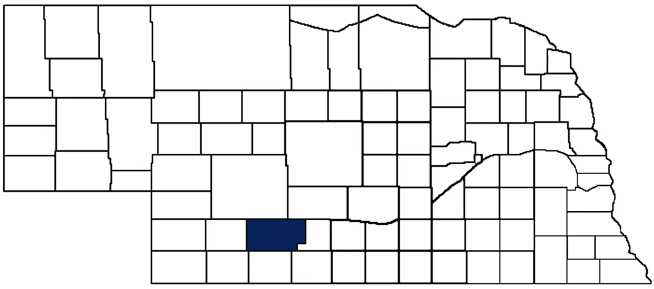
- General Info
- Demographics
- Education and Employment
- Valuation and Taxes Levied
- State Senators
- History
- County Programs
- Other Information
Communities & Development
Frontier County Seat: Stockville
Total County Population: 2,655
- Cities (pop. & class): Curtis (843 • 2nd Class)
- Villages (pop.): Eustis (418), Maywood (257), Moorefield (27), Stockville (23)
- Unincorporated Pop. (% of total county pop.): 1,069 (40%) 2020
Land Development (% of total land in county):
- Agriculture: 95%
- By method: Pasture (pure grassland) (58%), Dryland (row crop/grain/forage) (24%), Irrigated (row crop/grain/forage) (12%), • Neb. Dept. of Rev. - total equals agriculture's %
- By commodity: Livestock (grassland) 59%, Corn 20%, Soybeans 4%, Sorghum 4%, Wheat 4%, Alfalfa 1% • USDA - equals agriculture's % plus some fallow land (3%) and some wetlands (2%) and minus public grassland/wetlands and reserve
- Residential, Commercial, Industrial, Conservation Reserve & Exempt (combined): 5% 2022
County Offices
Courthouse Address and Hours:
1 Wellington Street
Stockville, Nebraska 69042
M-F 8:00 am - 12:30 pm; 1:00 pm - 4:00 pm
Complete list of county board members
County Board Meetings: 1st Tuesday
View the County's Government Maps
NACO District: West Central
West Central District Officers
General
Population: 2,655
Land area (sq. mi.): 974.63
Population per square mile: 2.7
Race & Age
Race 2024
White: 91.1%
African American: 0.1%
American Indian: 0.2%
Asian: 0.4%
Hispanic: 4.9%
Native Hawaiian and Pacific Islander: 0.0%
Two or More Races: 3.3%
Age 2024
0-17: 20.6%
18-64: 54.7%
65+: 25.4%
Households
Total households: 1,074 2024
With one child: 100 2023
With 2+ children: 180 2023
With seniors (65+): 150 2023
Socioeconomics
Personal income per capita: $70,132 2024
% of Population in Poverty: 11.3% 2024
# of Housing Units: 1,350 2024
Owner-occupied rate: 71.9% 2024
Median home price: $155,980 Q4 2025
2024 building permits for detached single family homes: 1
2024 building permits for non-detached housing units: 5 (townhouse, duplex, or apt. unit)
Technology
Access to broadband (100 Mbps via fiber or cable modem): 89.5% 2025
Sources: National Association of Realtors, Nebraska Department of Revenue, Nebraska Legislature, Nebraska Library Commission, U.S. Bureau of Economic Analysis, U.S. Census Bureau (building permits), U.S. Census Bureau (demographics), U.S. Census Bureau (municipalities)
Employment, Schools, and Child Care
Unemployment rate: 3.5% February 2026
County Employment Website: https://www.adamscounty.org/employment
High school graduate or higher: 93.7% 2024
School Districts: Arapahoe Public Schools, Cambridge Public Schools, Elwood Public Schools, Eustis-Farnam Public Schools, Hayes Center Public Schools, Maywood Public Schools, McCook Public Schools, Medicine Valley Public Schools
Bachelor's degree or higher: 25.7% 2024
Community College Service Area: Central Community College
County child care capacity: 2 providers; 55 children 2026
Find child care: For a list of child care providers in your zip code, visit Nebraska DHHS or the Nebraska Resource and Referral System.
Frontier County Economy
Annual Gross Domestic Product (GDP): $104,152,000 2024
Nonfarm Small Business Receipts: $34,593,876 2023
Nonfarm Wage Income: $43,740,000 2022
Farm and Ranch Commodity Sales Receipts: $180,689,000 2022
Farm and Ranch Operations (Non-Sales) Receipts: $12,617,000 2022
- For components of nonfarm small business receipts, nonfarm wage income, and farm & ranch commodity sales and operations receipts, see "Notes" below.
Grain Elevators by Location (bushels capacity):
- Eustis: Ag Valley (3,068,357)
- Maywood: Ag Valley (4,842,826)
- (1 bushel = 56 lbs. corn/sorghum, 60 lbs. soybeans/wheat; % max. moisture = 18% beans, 15.5% corn, 14% sorghum/soybeans, 13.5% wheat)
Railroad Miles: 32.09 main, 3.66 side
- Places with Railroad Service: Curtis, Eustis, Maywood, Moorefield
Local Grain Market: Click for today's grain prices in Frontier County
Cattle Producers: 222
- Dryland Cash Rent (avg.): $28/acre/yr 2025
Crop Producers: 116
- Dryland Cash Rent (avg.): $61/acre/yr 2025
- Irrigated Land Cash Rent (avg.): $206/acre/yr 2025
Oil Wells Producing (barrels of oil/yr.): 9 wells (14,019 barrels)
Electricity Providers: City of Curtis, Dawson PPD, McCook PPD, Southwest PPD, Twin Valleys PPD
Notes
- Nonfarm small business receipts are reported by partnerships and sole proprietorships. They do not include receipts reported by cooperative associations.
- Nonfarm wage income is reported based upon the wage earner's residential address; therefore, it also includes wages earned by Frontier County residents in other counties or states, but it excludes wages earned in Frontier County by residents of other counties or states.
- Nonfarm wage income excludes wages earned by anyone claimed as a dependent.
- Farm and ranch commodity sales receipts and operations receipts are reported based upon the farm or ranch owner's principal county of operations; therefore, those figures also include receipts reported by producers operating principally in Frontier County for their production in other counties or states, but the figures exclude receipts reported for production in Frontier County by producers operating principally in other counties or states.
Well Locations (Irrigation/Livestock), Soils, Groundwater & Surface Water
Total Irrigation/Livestock Wells: 969 2026
Rural Commercial/Industrial Wells: 3 2026
Rural Drinking Water Wells: 138 2026
Drinking Water Utility Connections: 693 Residential; 169 Commercial; 0 Industrial 2024
Irrigation/Livestock Wells per Square Mile: 0.99 2026
Surface Water Diversions (Irrigation): 51 2024
Sources: National Agricultural Statistics Service (USDA), Nebraska Cooperative Council, Nebraska Coordinating Commission for Postsecondary Education, Nebraska Department of Health and Human Services, Nebraska Department of Revenue, Nebraska Department of Transportation, Nebraska Office of the CIO, Nebraska Power Review Board, Nebraska Public Service Commission, U.S. Bureau of Economic Analysis, U.S. Bureau of Labor Statistics, U.S. Census Bureau, U.S. Energy Information Administration, U.S. Department of the Treasury (IRS), Warehouse and Commodity Management Division (USDA)
2025 Levies and Valuation
County levy rate: $0.219 per $100 of taxable valuation
County property taxes levied: $2,719,366
Total local government property taxes levied: $14,429,297
Total countywide taxable valuation: $1,241,135,779
Federal PILT payment to Frontier County (FY2024): $48,372 regarding 13,989 federally-owned acres
Click here for all levy rates in Frontier County
County Levy and Taxation Laws
Levy limits
Since 1996, counties and other political subdivisions have been subject to the levy limits listed in Neb. Rev. Stat. § 77-3442 and Neb. Rev. Stat. § 77-3443.
Statutes and regulations
Nebraska Revised Statutes (Chapter 77)
Nebraska Administrative Code (Title 350)
Neb. Rev. Stat. § 77-201(2) (Valuation of agricultural land and horticultural land): "Agricultural land and horticultural land as defined in section 77-1359 shall constitute a separate and distinct class of property for purposes of property taxation, shall be subject to taxation, unless expressly exempt from taxation, and shall be valued at seventy-five percent of its actual value, except that for school district taxes levied to pay the principal and interest on bonds that are approved by a vote of the people on or after January 1, 2022, such land shall be valued at fifty percent of its actual value."
Neb. Rev. Stat. § 77-6703(1) (Tax credit for school district taxes paid): "(1) For taxable years beginning or deemed to begin on or after January 1, 2020, under the Internal Revenue Code of 1986, as amended, there shall be allowed to each eligible taxpayer a refundable credit against the income tax imposed by the Nebraska Revenue Act of 1967 or against the franchise tax imposed by sections 77-3801 to 77-3807. The credit shall be equal to the credit percentage for the taxable year, as set by the department under subsection (2) of this section, multiplied by the amount of school district taxes paid by the eligible taxpayer during such taxable year."
Sources: Nebraska Department of Revenue
State Senator: Teresa J. Ibach (District 44)
Committees
- Agriculture
- Business and Labor
- Revenue
- Committee On Committees
- Reference
- Rules
- Executive Board
Map and statistics for Legislative District 44
Map of all districts in the Nebraska Unicameral Legislature

Frontier County History
Number of Registered Historic Places: 2
Year Authorized: 1872
Year Organized: 1872
Etymology: Reference to its location as unorganized territory in Nebraska's southwest frontier.
Frontier County may not have been Nebraska’s final frontier, but upon its founding in 1872, it represented some of the furthest western organized territory in the state. Many of the settlements in Frontier County drew their names from local settlers or the ranching livelihood of early residents. The city of Curtis, for example, takes its name from a local trapper, while the name of Stockville reflects the numerous livestock owned by the first ranchers.
Like many Nebraska counties, the history of Frontier County featured confrontations between Native American tribes and European settlers moving west. In Frontier County, a band of Oglala were occupying territory near present-day Stockville when their chief and two other Oglala tribesman were killed; their murders were never solved. Soon after, the Oglala departed for a reservation and ranchers spread livestock over the abundant ranchland. The railroad soon followed.
Frequently, the community that experiences a population boom due to the railroad often claims the county seat, but not so in Frontier County. Despite being founded over a decade after Stockville, Curtis grew much more rapidly due to its status a railroad town. Within three decades, Curtis had tripled in size while Stockville lost more than ten percent of its residents. Yet Stockville remained the county seat, surviving multiple calls over subsequent decades to move the seat to Curtis. Today, Stockville retains both the proud seat of Frontier County and the courthouse built in 1888.
Highlight an important program in your county in this space! Send an email to:
Local Highlights
License Plate Number: 60
Time Zone: Central
Number of Veterans: 121 2026
Zoned County: Yes
Number of County-Owned Bridges: 75
Number of County-Owned Dams: 8
Election Data
Voter Turnout: 76% 2024
Number of Registered Voters: 1,781 2024
Number of Precincts: 5 2024
Number of Election Day Polling Places: 5 2024
Land Area per Polling Place (avg.): 194.93 sq. miles
Intergovernmental Data
Emergency Mgt. Planning, Exercise and Training (PET) Region: South Central
Natural Resource Districts: Middle Republican NRD, Central Platte NRD
State Lands (acres): Medicine Creek SRA (1,007), Medicine Creek WMA (7,487), Red Willow Reservoir SRA (1,358 Frontier & Red Willow), Red Willow Reservoir WMA (4,591 Frontier & Red Willow)
Federal Lands (acres): Medicine Creek Operations (449), Red Willow Reservoir Operations (141)
Sources: Nebraska Department of Transportation, Nebraska Emergency Management Agency, Nebraska Game & Parks Commission, Nebraska Legislature, Nebraska Office of the CIO, Nebraska Secretary of State, U.S. Department of Veterans Affairs, U.S. Election Assistance Commission, U.S. National Archives and Records Administration (eCFR)