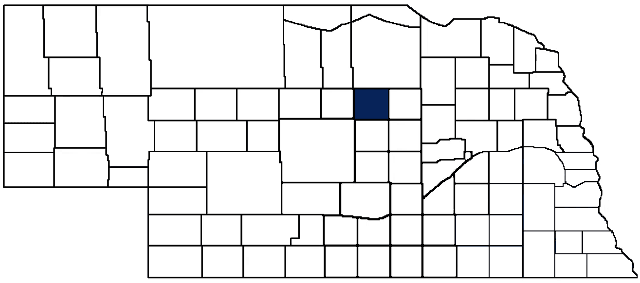
- General Info
- Demographics
- Education and Employment
- Valuation and Taxes Levied
- State Senators
- History
- County Programs
- Other Information
Communities & Development
Garfield County Seat: Burwell
Total County Population: 1,710
- Cities (pop. & class): Burwell (1,018 • 2nd Class)
- Unincorporated Pop. (% of total county pop.): 692 (40%) 2025
Land Development (% of total land in county):
- Agriculture: 95.5%
- By method: Pasture (pure grassland) (87%), Irrigated (row crop/grain/forage) (6%), Dryland (row crop/grain/forage) (2%) • Neb. Dept. of Rev. - total equals agriculture's %
- By commodity: Livestock (grassland) 84%, Corn 3%, Soybeans 1%, Alfalfa 1%, Sorghum 1% • USDA - equals agriculture's % plus some wetlands (5%) and minus public grassland/wetlands and reserve
- Residential, Commercial, Industrial, Conservation Reserve & Exempt (combined): 4.5% 2022
County Offices
Courthouse Address and Hours:
250 South 8th Street
Burwell, Nebraska 68823
M-F 8:30 am - 12:30 pm; 1:00 pm - 4:00 pm
Complete list of county board members
County Board Meetings: 2nd & 4th Tuesday
View the County's Government Maps
NACO District: Central
General
Population: 1,710
Land area (sq. mi.): 569.33
Population per square mile: 3.0
Race & Age
Race 2025
White: 96.7%
African American: 0.2%
American Indian: 0.1%
Asian: 0.0%
Hispanic: 1.7%
Native Hawaiian and Pacific Islander: 0.0%
Two or More Races: 1.2%
Age 2025
0-17: 20.4%
18-64: 49.9%
65+: 29.5%
Households
Total households: 701 2024
With one child: 80 2024
With 2+ children: 100 2024
With seniors (65+): 130 2024
Socioeconomics
Median household income: $62,804 2024
% of Population in Poverty: 11.8% 2024
# of Housing Units: 990 2024
Owner-occupied rate: 68.4% 2024
Median home price: $183,880 Q4 2025
2024 building permits for detached single family homes: 4
2024 building permits for non-detached housing units: 124 (townhouse, duplex, or apt. unit)
Technology
Access to broadband (100 Mbps via fiber or cable modem): 98.0% 2025
Sources: National Association of Realtors, Nebraska Department of Revenue, Nebraska Legislature, Nebraska Library Commission, U.S. Bureau of Economic Analysis, U.S. Census Bureau (building permits), U.S. Census Bureau (demographics), U.S. Census Bureau (municipalities)
Employment, Schools, and Child Care
Unemployment rate: 2.9% February 2026
County Employment Website: https://garfieldcounty.ne.gov/webpages/links/public_notices.html
High school graduate or higher: 95.7% 2024
School Districts: Burwell Public Schools, Chambers Public School, Wheeler Central Schools
Bachelor's degree or higher: 29.7% 2024
Community College Service Area: Northeast Community College
Countywide child care capacity: 5 providers; 98 children 2026
Find child care: For a list of child care providers in your zip code, visit Nebraska DHHS or the Nebraska Resource and Referral System.
Garfield County Economy
Annual Gross Domestic Product (GDP): $114,343,000 2024
Nonfarm Small Business Receipts: $39,634,750 2023
Nonfarm Wage Income: $28,556,000 2022
Farm and Ranch Commodity Sales Receipts: $116,130,000 2022
Farm and Ranch Operations (Non-Sales) Receipts: $6,486,000 2022
- For components of nonfarm small business receipts, nonfarm wage income, and farm & ranch commodity sales and operations receipts, see "Notes" below.
Local Grain Market: Click for today's grain prices in Garfield County
Cattle Producers: 121
- Pastureland Cash Rent (avg.): $31/acre/yr 2024
Crop Producers: 52
- Dryland Cash Rent (avg.): $233/acre/yr 2024
Electricity Providers: City of Burwell, Custer PPD, Loup Valleys Rural PPD, Niobrara Valley Electric Membership Corp.
Notes
- Nonfarm small business receipts are reported by partnerships and sole proprietorships. They do not include receipts reported by cooperative associations.
- Nonfarm wage income is reported based upon the wage earner's residential address; therefore, it also includes wages earned by Garfield County residents in other counties or states, but it excludes wages earned in Garfield County by residents of other counties or states.
- Nonfarm wage income excludes wages earned by anyone claimed as a dependent.
- Farm and ranch commodity sales receipts and operations receipts are reported based upon the farm or ranch owner's principal county of operations; therefore, those figures also include receipts reported by producers operating principally in Garfield County for their production in other counties or states, but the figures exclude receipts reported for production in Garfield County by producers operating principally in other counties or states.
Irrigation, Drinking Water, and Soils
Rural Irrigation/Livestock Wells: 456 2026
Rural Commercial/Industrial Wells: 5 2026
Rural Drinking Water Wells: 168 2026
Drinking Water Utility Connections: 525 Residential; 86 Commercial; 0 Industrial 2024
Irrigation/Livestock Wells per Square Mile: 0.80 2026
Surface Water Diversions (Irrigation): 67 2024
Notes
- A rural irrigation well is any well intended for irrigating crops that, either on its own or as part of a set of commingled wells, is capable of pumping more than fifty (50) gallons of water per minute (gpm). Note that some rural commercial/industrial wells are also capable of pumping more than 50 gpm. In Nebraska, the owner of any well--or set of commingled wells--that is capable of pumping more than 50 gpm must register the well(s) with the state government and have a permit for the well(s) from the local natural resource district (NRD).
- Rural livestock wells and rural drinking water (also known as "domestic") wells are not allowed to pump more than 50 gpm unless permitted by the local NRD. Each rural drinking water well usually serves one single family home, though in rare cases a rural drinking water well serves multiple homes.
- Data on rural livestock wells and rural drinking water wells may be incomplete for wells drilled prior to September 9, 1993. State law does not require wells drilled prior to that date to be registered with the state government if the wells are not capable of pumping more than 50 gpm. Neb. Rev. Stat. § 46-735; see Laws 1993, LB 131, § 25.
Sources: National Agricultural Statistics Service (USDA), Nebraska Cooperative Council, Nebraska Coordinating Commission for Postsecondary Education, Nebraska Department of Health and Human Services, Nebraska Department of Revenue, Nebraska Department of Transportation, Nebraska Office of the CIO, Nebraska Power Review Board, Nebraska Public Service Commission, U.S. Bureau of Economic Analysis, U.S. Bureau of Labor Statistics, U.S. Census Bureau, U.S. Energy Information Administration, U.S. Department of the Treasury (IRS), Warehouse and Commodity Management Division (USDA)
2024 Levies and Valuation
County levy rate: $0.326 per $100 of taxable valuation
County property taxes levied: $2,180,294
Total local government property taxes levied: $8,607,452
Total countywide taxable valuation: $669,050,098
Federal PILT payment to Garfield County (FY2024): $7,169 regarding 2,073 federally-owned acres
Click here for all levy rates in Garfield County
County Levy and Taxation Laws
Levy limits
Since 1996, counties and other political subdivisions have been subject to the levy limits listed in Neb. Rev. Stat. § 77-3442 and Neb. Rev. Stat. § 77-3443.
Statutes and regulations
Nebraska Revised Statutes (Chapter 77)
Nebraska Administrative Code (Title 350)
Local tax reductions, exemptions, and credits:
Neb. Rev. Stat. § 76-902(5)(a) (Deed "stamp tax" exemption): "The [stamp tax] shall not apply to: ... (5)(a) Deeds between spouses, between ex-spouses for the purpose of conveying any rights to property acquired or held during the marriage, or between parent and child, without actual consideration therefor."
Neb. Rev. Stat. § 77-201(2) (Valuation of agricultural land and horticultural land): "Agricultural land and horticultural land as defined in section 77-1359 shall constitute a separate and distinct class of property for purposes of property taxation, shall be subject to taxation, unless expressly exempt from taxation, and shall be valued at seventy-five percent of its actual value, except that for school district taxes levied to pay the principal and interest on bonds that are approved by a vote of the people on or after January 1, 2022, such land shall be valued at fifty percent of its actual value."
Neb. Rev. Stat. § 77-6703(1) (Tax credit for school district taxes paid): "(1) For taxable years beginning or deemed to begin on or after January 1, 2020, under the Internal Revenue Code of 1986, as amended, there shall be allowed to each eligible taxpayer a refundable credit against the income tax imposed by the Nebraska Revenue Act of 1967 or against the franchise tax imposed by sections 77-3801 to 77-3807. The credit shall be equal to the credit percentage for the taxable year, as set by the department under subsection (2) of this section, multiplied by the amount of school district taxes paid by the eligible taxpayer during such taxable year."
Sources: Nebraska Department of Revenue
State Senator: Tanya Storer (District 43)
Committees
Map and statistics for Legislative District 43
Map of all districts in the Nebraska Unicameral Legislature

Garfield County History
Number of Registered Historic Places: 3
Year Authorized: 1884
Year Organized: 1884
Etymology: James Garfield (20th U.S. president)
Originally part of Wheeler County, Garfield County split off and became organized in 1884. Its name pays tribute to President James Garfield, who was assassinated in 1881. Although Burwell is perhaps the county’s best-known community, early odds were on the town of Willow Springs to become Wheeler County’s enduring city. However, the railroad ended up passing through Burwell, spurring a population boom that dried up Willow Springs. In 1890, county residents voted to move the county seat to Burwell, whose proximity to the railroad, river, and fertile farmland drew residents from the rest of the county. In fact, Garfield County once featured nearly a dozen towns, but today, Burwell remains the only incorporated community.
Following Burwell’s election as the county seat, residents built the first courthouse. Unlike many other county courthouses which lasted only a few decades, Garfield County’s first courthouse lasted until the early 1960’s, despite its humble wooden structure. In 1963, the county completed construction of its current courthouse. Notably, U.S. Senator Roman Hruska, formerly the NACO president, delivered the dedication for the new courthouse.
Garfield County is a county of mixed and beautiful topography. The northern part of the county witnesses the beginnings of the Sandhills, the southern half offers fertile farmland, and the southeast corner features the twisting, scenic North Loup River. Notably, the river does not derive its name from its “looping” path, but from the French word for “wolf.” The river was named for a band of Pawnee Native Americans whose name was translated as “Wolf People.”
Highlight an important program in your county in this space! Send an email to:
Local Highlights
License Plate Number: 83
Time Zone: Central
Number of Veterans: 109 2023
Zoned County: Yes
Number of County-Owned Bridges: 14
County Library: Garfield County Library
Election Data
Voter Turnout: 78% 2024
Number of Registered Voters: 1,276 2024
Number of Precincts: 2 2024
Number of Election Day Polling Places: 1 2024
Land Area per Polling Place (avg.): 569.33 sq. miles
Intergovernmental Data
Emergency Mgt. Planning, Exercise and Training (PET) Region: North Central/Sandhills
Natural Resource District: Lower Loup NRD
State Lands (acres): Calamus Fish Hatchery (136), Calamus Reservoir WMA (9,942 Garfield & Loup), Mirdan Canal WMA (52)
Sources: Nebraska Department of Transportation, Nebraska Emergency Management Agency, Nebraska Game & Parks Commission, Nebraska Legislature, Nebraska Office of the CIO, Nebraska Secretary of State, U.S. Department of Veterans Affairs, U.S. Election Assistance Commission, U.S. National Archives and Records Administration (eCFR)