- General Info
- Demographics
- Education and Employment
- Valuation and Taxes Levied
- State Senators
- History
- County Programs
- Other Information
Communities and Development
Jefferson County Seat (pop.): Fairbury
Total County Population: 7,240
- Cities (pop. & class): Fairbury (3,970 • 2nd Class)
- Villages (pop.): Daykin (153), Diller (247), Endicott (113), Harbine (56), Jansen (101), Plymouth (364), Reynolds (57), Steele City (44)
- Unincorporated Pop. (% of county pop.): 2,135 (29%) 2020
Land Development (% of total land in county):
- Agriculture: 90%
- By method: Dryland (row crop/grain/forage) (35%); Irrigated (row crop/grain/forage) (28%); Pasture (pure grassland) (27%) • Neb. Dept. of Rev. - total equals agriculture's %
- By commodity: Corn 31%, Soybeans 28%, Livestock (grassland) 25%, Wheat 2%, Alfalfa 2%, Other Hay 1% • USDA - equals agriculture's % plus some wetlands (0.25%) and minus public grassland/wetlands and reserve
- Residential, Commercial, Industrial, Conservation Reserve & Exempt (combined): 8%
- Timber: 2% 2022
County Offices
Courthouse Address and Hours:
411 4th Street
Fairbury, Nebraska 68352
M-F 8:00 am - 5:00 pm
Complete list of county board members
County Board Meetings: Every Tuesday (except the 5th Tuesday)
View the County's Government Maps
NACO District: Southeast
General
Population: 7,240
Land area (sq. mi.): 570.18
Population per square mile: 12.7
Race & Age
Race 2020
White: 90.6%
African American: 0.3%
American Indian: 0.6%
Asian: 0.2%
Hispanic: 5.0%
Native Hawaiian and Pacific Islander: 0.0%
Two or More Races: 3.1%
Age 2020
0-17: 22.7%
18-64: 53.1%
65+: 24.2%
Households
Total households: 3,179 2020
With one child: 310 2022
With 2+ children: 450 2022
With seniors (65+): 930 2022
Socioeconomics
Median household income: $60,568 2023
% of Population in Poverty: 10.6% 2023
# of Housing Units: 3,665 2020
Owner-occupied rate: 73.7% 2020
Median home price: $127,210 Q4 2024
2024 building permits for detached single family homes: 9
2024 building permits for non-detached housing units: 0 (townhouse, duplex, or apt. unit)
Technology
Access to broadband (100 Mbps via fiber or cable modem): 51.2% 2021
Sources: National Association of Realtors, Nebraska Department of Revenue, Nebraska Legislature, Nebraska Library Commission, U.S. Bureau of Economic Analysis, U.S. Census Bureau (building permits), U.S. Census Bureau (demographics), U.S. Census Bureau (municipalities)
Employment, Schools, and Child Care
Unemployment rate: 2.7% March 2025
County Employment Website: https://nebraskacounties.org/nebraska-counties/county-employment-opportunities.html
High school graduate or higher: 90.4% 2020
School Districts: Diller-Odell Public Schools, Fairbury Public Schools, Meridian Public Schools, Tri County Public Schools
Bachelor's degree or higher: 18.3% 2020
Community College Service Area: Southeast Community College
Countywide child care capacity: 13 providers; 258 children 2024
Find child care: For a list of child care providers in your zip code, visit Nebraska DHHS or the Nebraska Resource and Referral System.
Jefferson County Economy
Annual Gross Domestic Product (GDP): $626,940,000 2023
Nonfarm Small Business Receipts: $66,832,436 2022
Nonfarm Wage Income: $138,062,000 2022
Farm and Ranch Commodity Sales Receipts: $295,644,000 2022
Farm and Ranch Operations (Non-Sales) Receipts: $9,043,000 2022
- For components of nonfarm small business receipts, nonfarm wage income, and farm & ranch commodity sales and operations receipts, see "Notes" below.
Grain Elevators by Location (bushels capacity):
- Daykin: Farmers (3,148,106)
- Diller: Farmers (85,205)
- Dorchester: Farmers (6,855,106)
- Harbine: Farmers (208,015)
- Jansen: Farmers (6,150,644)
- Plymouth: Farmers (3,660,589)
- Reynolds: Farmers (3,259,758)
- (1 bushel = 56 lbs. corn/sorghum, 60 lbs. soybeans/wheat; % max. moisture = 18% beans, 15.5% corn, 14% sorghum/soybeans, 13.5% wheat)
Railroad Miles: 76.36 main, 7.71 side
- Places with Railroad Service: Endicott, Fairbury, Jansen, Plymouth, Steele City
Local Grain Market: Click for today's grain prices in Jefferson County
Cattle Producers: 204
- Pastureland Cash Rent (avg.): $46/acre 2024
Crop Producers: 199
- Dryland Cash Rent (avg.): $156/acre 2024
- Irrigated Land Cash Rent (avg.): $286/acre 2024
Dairy Producers: 5
Farmers Market: Fairbury Farmers Market (Downtown) (May - October, Saturdays 8 AM - 11 AM)
Electricity Providers: City of Fairbury, Norris PPD, Village of Endicott, Village of Reynolds
Wind Turbines Operating (MW): 32 turbines (54,400 MW)
Irrigation and Drinking Water
Rural Irrigation Wells: 918 2024
Rural Livestock Wells: 99 2024
Rural Commercial/Industrial Wells: 3 2024
Rural Drinking Water Wells: 187 2024
Drinking Water Utility Connections: 2,689 Residential; 404 Commercial; 1 Industrial 2024
Surface Water Diversions (Irrigation): 223 2024
Click for real time:
Streamflow data on the Little Blue River near Fairbury
Groundwater level data near NE Hwy 4 & 576th Ave. (2 mi. west of Plymouth)
Notes
Jefferson County Economy
- Nonfarm small business receipts are reported by partnerships and sole proprietorships. They do not include receipts reported by cooperative associations.
- Nonfarm wage income is reported based upon the wage earner's residential address; therefore, it also includes wages earned by Jefferson County residents in other counties or states, but it excludes wages earned in Jefferson County by residents of other counties or states.
- Nonfarm wage income excludes wages earned by anyone claimed as a dependent.
- Farm and ranch commodity sales receipts and operations receipts are reported based upon the farm or ranch owner's principal county of operations; therefore, those figures also include receipts reported by producers operating principally in Jefferson County for their production in other counties or states, but the figures exclude receipts reported for production in Jefferson County by producers operating principally in other counties or states.
Irrigation and Drinking Water
- A rural irrigation well is any well intended for irrigating crops that, either on its own or as part of a set of commingled wells, is capable of pumping more than fifty (50) gallons of water per minute (gpm). Note that some rural commercial/industrial wells are also capable of pumping more than 50 gpm. In Nebraska, the owner of any well--or set of commingled wells--that is capable of pumping more than 50 gpm must register the well(s) with the state government and have a permit for the well(s) from the local natural resource district (NRD).
- Rural livestock wells and rural drinking water (also known as "domestic") wells are not allowed to pump more than 50 gpm unless permitted by the local NRD. Each rural drinking water well usually serves one single family home, though in rare cases a rural drinking water well serves multiple homes.
- Data on rural livestock wells and rural drinking water wells may be incomplete for wells drilled prior to September 9, 1993. State law does not require wells drilled prior to that date to be registered with the state government if the wells are not capable of pumping more than 50 gpm. Neb. Rev. Stat. § 46-735; see Laws 1993, LB 131, § 25.
Sources: National Agricultural Statistics Service (USDA), Nebraska Cooperative Council, Nebraska Coordinating Commission for Postsecondary Education, Nebraska Department of Health and Human Services, Nebraska Department of Revenue, Nebraska Department of Transportation, Nebraska Office of the CIO, Nebraska Power Review Board, Nebraska Public Service Commission, U.S. Bureau of Economic Analysis, U.S. Bureau of Labor Statistics, U.S. Census Bureau, U.S. Energy Information Administration, U.S. Department of the Treasury (IRS), Warehouse and Commodity Management Division (USDA)
2024 Levies and valuation
County levy rate: $0.3193 per $100 of taxable valuation
County property taxes levied: $7,428,991
Total local government property taxes levied: $29,362,875
Total countywide taxable valuation: $2,326,384,000
Click here for all levy rates in Jefferson County
County Levy and Taxation Laws
Levy limits
Since 1996, counties and other political subdivisions have been subject to the levy limits listed in Neb. Rev. Stat. § 77-3442 and Neb. Rev. Stat. § 77-3443.
Statutes and regulations
Nebraska Revised Statutes (Chapter 77)
Nebraska Administrative Code (Title 350)
Local tax reductions, exemptions, and credits
Neb. Rev. Stat. § 76-902(5)(a) (Deed "stamp tax" exemption): "The [stamp tax] shall not apply to: ... (5)(a) Deeds between spouses, between ex-spouses for the purpose of conveying any rights to property acquired or held during the marriage, or between parent and child, without actual consideration therefor."
Neb. Rev. Stat. § 77-201(2) (Valuation of agricultural land and horticultural land): "Agricultural land and horticultural land as defined in section 77-1359 shall constitute a separate and distinct class of property for purposes of property taxation, shall be subject to taxation, unless expressly exempt from taxation, and shall be valued at seventy-five percent of its actual value, except that for school district taxes levied to pay the principal and interest on bonds that are approved by a vote of the people on or after January 1, 2022, such land shall be valued at fifty percent of its actual value."
Neb. Rev. Stat. § 77-6703(1) (Tax credit for school district taxes paid): "(1) For taxable years beginning or deemed to begin on or after January 1, 2020, under the Internal Revenue Code of 1986, as amended, there shall be allowed to each eligible taxpayer a refundable credit against the income tax imposed by the Nebraska Revenue Act of 1967 or against the franchise tax imposed by sections 77-3801 to 77-3807. The credit shall be equal to the credit percentage for the taxable year, as set by the department under subsection (2) of this section, multiplied by the amount of school district taxes paid by the eligible taxpayer during such taxable year."
Sources: Nebraska Department of Revenue
State Senator: Tom Brandt (District 32)
Committees
- Natural Resources
- Transportation and Telecommunications
- Committee On Committees
- Building Maintenance
- Statewide Tourism And Recreational Water Access and Resource Sustainability (LB406)
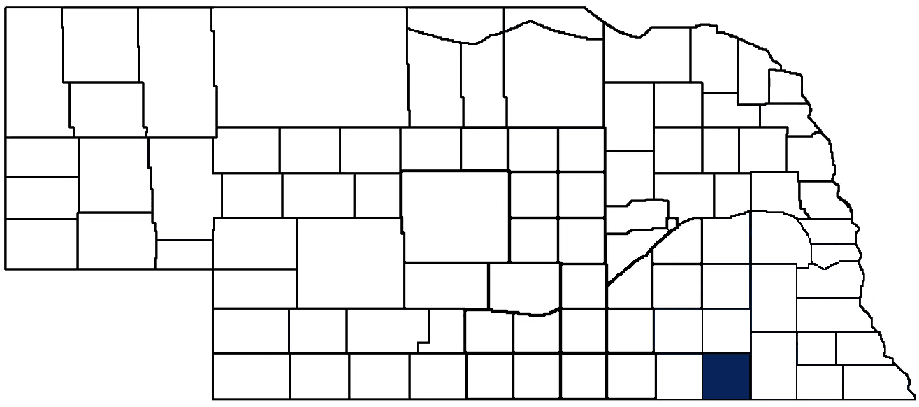
Map and statistics for Legislative District 32
Map of all districts in the Nebraska Unicameral Legislature

Jefferson County History
Number of Registered Historic Places: 14
Year Authorized: 1856
Year Organized: 1864
Etymology: Thomas Jefferson (U.S. president)
Jefferson County was formed in 1856 as a part of a larger redistricting initiative that completely reorganized eastern Nebraska (including creating a dozen new counties). However, Jefferson County’s first name was Jones County. It wasn’t until 1867 that the name was changed to honor the nation’s third president and author of the Declaration of Independence, Thomas Jefferson. In 1871, the Legislature divided Jefferson County in half, creating Thayer County out of the western portion.
As with other Nebraska counties, Jefferson County was inhabited for hundreds of years by Native American tribes prior to the arrival of European settlers. In fact, according to some historians, one of the largest Native American battles occurred in northwestern Jefferson County, near the confluence of the Little Blue River and Big Sandy River. The battle between the Sioux and Pawnee raged for three days, and reports indicate that over 5,000 warriors died. The Pawnee would retain control of the area, but the victory was short-lived. European settlement aided by the U.S. Army eventually displaced the Pawnee (and every other Native American tribe), relegating them to reservations.
Prior to its formal organization, Jefferson County welcomed both the Oregon Trail and Pony Express Route. The Rock Creek Station was a welcome stop for travelers, offering supplies and shelter. Later, the station would give Nebraska an infamous historical event—the killing of Wild Bill Hickok’s first victim. Accounts vary, but Hickok allegedly killed a man who was arguing with the station manager. A jury found that Hickok acted in self-defense, one of many returned verdicts that justified Hickok’s questionable use of lethal force.
The early days of Jefferson County posed formidable challenges to settlers. Conflicts with Native American tribes and droughts were common in Jefferson County, but the 1874 grasshopper infestation was particularly nefarious. Numerous historical accounts report that clouds of grasshoppers blocked out the sun, darkening the sky and warning settlers of their impending arrival. Upon landing, the grasshoppers ate everything from field crops to garden vegetables to honey-combed chimneys to curtains and nettings. So great were their numbers that upon being run over and crushed by trains, the oil of the grasshoppers greased the rails and caused train wheels to spin without pulling the cars down the track.
Despite all these obstacles, Jefferson County residents persevered, and their mettle helped found a dozen communities, including the county seat of Fairbury. The city would become a railroad shipping hub that sparked a minor population boom which continued well into the 20th century. Today, Jefferson County is known for both its agriculture and manufacturing.
Highlight an important program in your county in this space! Send an email to:
Local Highlights
License Plate Number: 33
Time Zone: Central
Number of Veterans: 462 2023
Zoned County: Yes
Number of County-Owned Bridges: 206
Number of County-Owned Dams: 1
Election Data
General Election Turnout: 77% 2024
Total Registered Voters: 4,811 2024
Number of Precincts: 10 2022
Number of Election Day Polling Places: 9 2022
Land Area per Polling Place: 63.96 sq. miles
Intergovernmental Data
Emergency Mgt. Planning, Exercise and Training (PET) Region: Southeast
Natural Resource Districts: Little Blue NRD, Lower Big Blue NRD
State Lands (acres): Alexandria SRA (101), Alexandria WMA (1,204.54), Flathead WMA (259.20), Rock Creek State Historical Park (353), Rock Creek SRA (40), Rock Glen WMA (706), Rose Creek WMA (667.57)
Sources: Nebraska Department of Transportation, Nebraska Emergency Management Agency, Nebraska Game & Parks Commission, Nebraska Legislature, Nebraska Office of the CIO, Nebraska Secretary of State, U.S. Department of Veterans Affairs, U.S. Election Assistance Commission, U.S. National Archives and Records Administration (eCFR)