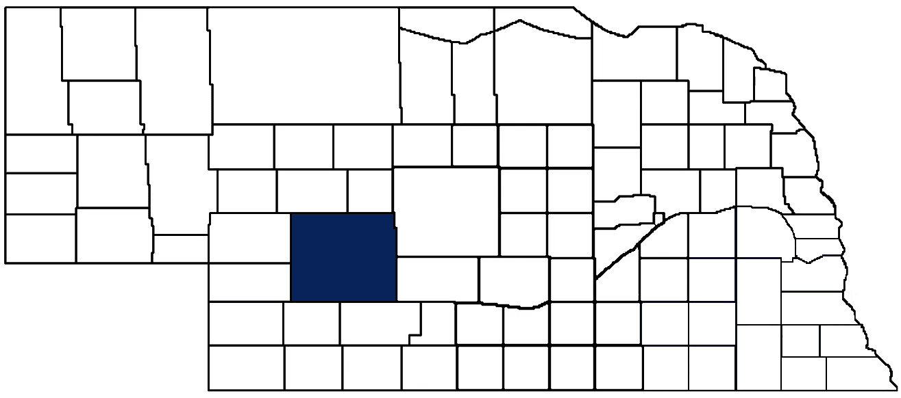
- General Info
- Demographics
- Education and Employment
- Valuation and Taxes Levied
- State Senators
- History
- County Programs
- Other Information
Communities and Development
Lincoln County Seat: North Platte
Total County Population: 34,676
- Cities (pop. & class): North Platte (23,390 • 1st Class)
- Villages (pop.): Brady (383), Hershey (649), Maxwell (257), Sutherland (1,313), Wallace (318), Wellfleet (72)
- Unincorporated Pop. (% of county pop.): 8,294 (24%) 2020
Land Development (% of total land in county):
- Agriculture: 92%
- By method: Pasture (pure grassland) (71%); Irrigated (row crop/grain/forage) (15%); Dryland (row crop/grain/forage) (6%) • Neb. Dept. of Rev. - total equals agriculture's %
- By commodity: Livestock (grassland) 71%, Corn 14%, Soybeans 4%, Alfalfa 2%, Wheat 1% • USDA - equals agriculture's % plus some wetlands (3%) and minus public grassland/wetlands and reserve
- Residential, Commercial, Industrial, Conservation Reserve & Exempt (combined): 8% 2022
County Offices
Courthouse Address and Hours:
301 North Jeffers Street
North Platte, Nebraska 69101
M-F 9:00 am - 5:00 pm
Complete list of county board members
County Board Meetings: Every Monday
View the County's Government Maps
NACO District: West Central
West Central District Officers
General
Population: 34,676
Land area (sq. mi.): 2,564.14
Population per square mile: 13.5
Race and Age
Race 2020
White: 85.5%
African American: 1.1%
American Indian: 0.4%
Asian: 0.9%
Hispanic: 8.7%
Native Hawaiian and Pacific Islander: 0.0%
Two or More Races: 3.0%
Age 2020
0-17: 23.5%
18-64: 55.9%
65+: 20.6%
Households
Total households: 14,683 2020
With one child: 1,920 2022
With 2+ children: 2,350 2022
With seniors (65+): 3,560 2022
Socioeconomics
Median household income: $64,342 2023
% of Population in Poverty: 11.9% 2023
# of Housing Units: 16,526 2020
Owner-occupied rate: 68.0% 2020
Median home price: $198,060 Q4 2024
2024 building permits for detached single family homes: 44
2024 building permits for non-detached housing units: 22 (townhouse, duplex, or apt. unit)
Technology
Access to broadband (100 Mbps via fiber or cable modem): 85.0% 2021
Sources: National Association of Realtors, Nebraska Department of Revenue, Nebraska Legislature, Nebraska Library Commission, U.S. Bureau of Economic Analysis, U.S. Census Bureau (building permits), U.S. Census Bureau (demographics), U.S. Census Bureau (municipalities)
Employment, Schools, and Child Care
Unemployment rate: 2.5% March 2025
County Employment Website: https://lincolncountyne.gov/employment-opportunities/
High school graduate or higher: 90.9% 2020
School Districts: Maxwell Public Schools, Maywood Public Schools, McPherson County Schools, Medicine Valley Public Schools, North Platte Public Schools, Paxton Consolidated Public Schools, Perkins County Schools, Stapleton Public Schools, Wallace Public School District 65 R
Bachelor's degree or higher: 25.6% 2020
Community College Service Area: Mid-Plains Community College
Countywide child care capacity: 31 providers; 1,158 children 2024
Find child care: For a list of child care providers in your zip code, visit Nebraska DHHS or the Nebraska Resource and Referral System.
Lincoln County Economy
Annual Gross Domestic Product (GDP): $3,178,522,000 2023
Nonfarm Small Business Receipts: $533,246,030 2022
Nonfarm Wage Income: $771,457,000 2022
Farm and Ranch Commodity Sales Receipts: $1,011,952,000 2022
Farm and Ranch Operations (Non-Sales) Receipts: $26,848,000 2022
- For components of nonfarm small business receipts, nonfarm wage income, and farm & ranch commodity sales and operations receipts, see "Notes" below.
Ethanol Plants (annual production capacity): Midwest Renewable Energy (28 million gallons)
Grain Elevators by Location (bushels capacity):
- Hershey: Scoular (1,702,348)
- North Platte: Ag Valley (3,229,008)
- Sutherland: Clatterbuck Elevator (2,611,000)
- Wallace: Scoular (1,231,000)
- (1 bushel = 56 lbs. corn/sorghum, 60 lbs. soybeans/wheat; % max. moisture = 18% beans, 15.5% corn, 14% sorghum/soybeans, 13.5% wheat)
Railroad Miles: 242.02 main, 308.46 side
- Places with Railroad Service: Brady, Dickens, Hershey, Maxwell, North Platte, Wellfleet
Local Grain Market: Click for today's grain prices in Lincoln County
Cattle Producers: 506
- Pastureland Cash Rent (avg.): $25/acre 2024
Crop Producers: 387
- Irrigated Land Cash Rent (avg.): $240/acre 2024
Farmers Market: The Original Farmers Market of North Platte (July - September, Tuesdays, 3 - 6 p.m. and Saturdays, 8:00 a.m. - 1:00 p.m.)
Electricity Providers: City of North Platte, Custer PPD, Dawson PPD, McCook PPD, Midwest Electric Member Corp., Nebraska PPD
Irrigation and Drinking Water
Rural Irrigation Wells: 2,229 2024
Rural Livestock Wells: 1,251 2024
Rural Commercial/Industrial Wells: 68 2024
Rural Drinking Water Wells: 1,645 2024
Drinking Water Utility Connections: 11,524 Residential; 2,138 Commercial; 0 Industrial 2024
Surface Water Diversions (Irrigation): 134 2024
Click for real time:
Groundwater level data near NE Hwy 97 along northern county line (17.5 mi. north of North Platte)
Notes
Lincoln County Economy
- Nonfarm small business receipts are reported by partnerships and sole proprietorships. They do not include receipts reported by cooperative associations.
- Nonfarm wage income is reported based upon the wage earner's residential address; therefore, it also includes wages earned by Lincoln County residents in other counties or states, but it excludes wages earned in Lincoln County by residents of other counties or states.
- Nonfarm wage income excludes wages earned by anyone claimed as a dependent.
- Farm and ranch commodity sales receipts and operations receipts are reported based upon the farm or ranch owner's principal county of operations; therefore, those figures also include receipts reported by producers operating principally in Lincoln County for their production in other counties or states, but the figures exclude receipts reported for production in Lincoln County by producers operating principally in other counties or states.
Irrigation and Drinking Water
- A rural irrigation well is any well intended for irrigating crops that, either on its own or as part of a set of commingled wells, is capable of pumping more than fifty (50) gallons of water per minute (gpm). Note that some rural commercial/industrial wells are also capable of pumping more than 50 gpm. In Nebraska, the owner of any well--or set of commingled wells--that is capable of pumping more than 50 gpm must register the well(s) with the state government and have a permit for the well(s) from the local natural resource district (NRD).
- Rural livestock wells and rural drinking water (also known as "domestic") wells are not allowed to pump more than 50 gpm unless permitted by the local NRD. Each rural drinking water well usually serves one single family home, though in rare cases a rural drinking water well serves multiple homes.
- Data on rural livestock wells and rural drinking water wells may be incomplete for wells drilled prior to September 9, 1993. State law does not require wells drilled prior to that date to be registered with the state government if the wells are not capable of pumping more than 50 gpm. Neb. Rev. Stat. § 46-735; see Laws 1993, LB 131, § 25.
Sources: National Agricultural Statistics Service (USDA), Nebraska Cooperative Council, Nebraska Coordinating Commission for Postsecondary Education, Nebraska Department of Health and Human Services, Nebraska Department of Revenue, Nebraska Department of Transportation, Nebraska Office of the CIO, Nebraska Power Review Board, Nebraska Public Service Commission, U.S. Bureau of Economic Analysis, U.S. Bureau of Labor Statistics, U.S. Census Bureau, U.S. Energy Information Administration, U.S. Department of the Treasury (IRS), Warehouse and Commodity Management Division (USDA)
2024 Levies and Valuation
County levy rate: $0.2763 per $100 of taxable valuation
County property taxes levied: $17,243,319
Total local government property taxes levied: $90,896,319
Total countywide taxable valuation: $6,241,200,093
Click here for all levy rates in Lincoln County
County Levy and Taxation Laws
Levy limits
Since 1996, counties and other political subdivisions have been subject to the levy limits listed in Neb. Rev. Stat. § 77-3442 and Neb. Rev. Stat. § 77-3443.
Statutes and regulations
Nebraska Revised Statutes (Chapter 77)
Nebraska Administrative Code (Title 350)
Local tax reductions, exemptions, and credits
Neb. Rev. Stat. § 76-902(5)(a) (Deed "stamp tax" exemption): "The [stamp tax] shall not apply to: ... (5)(a) Deeds between spouses, between ex-spouses for the purpose of conveying any rights to property acquired or held during the marriage, or between parent and child, without actual consideration therefor."
Neb. Rev. Stat. § 77-201(2) (Valuation of agricultural land and horticultural land): "Agricultural land and horticultural land as defined in section 77-1359 shall constitute a separate and distinct class of property for purposes of property taxation, shall be subject to taxation, unless expressly exempt from taxation, and shall be valued at seventy-five percent of its actual value, except that for school district taxes levied to pay the principal and interest on bonds that are approved by a vote of the people on or after January 1, 2022, such land shall be valued at fifty percent of its actual value."
Neb. Rev. Stat. § 77-6703(1) (Tax credit for school district taxes paid): "(1) For taxable years beginning or deemed to begin on or after January 1, 2020, under the Internal Revenue Code of 1986, as amended, there shall be allowed to each eligible taxpayer a refundable credit against the income tax imposed by the Nebraska Revenue Act of 1967 or against the franchise tax imposed by sections 77-3801 to 77-3807. The credit shall be equal to the credit percentage for the taxable year, as set by the department under subsection (2) of this section, multiplied by the amount of school district taxes paid by the eligible taxpayer during such taxable year."
Sources: Nebraska Department of Revenue
State Senator: Mike Jacobson (District 42)
Committees
- Banking, Commerce and Insurance
- Revenue
- Committee On Committees
- Reference
- Executive Board
- Legislative Performance Audit
- Statewide Tourism And Recreational Water Access and Resource Sustainability (LB406)
Map and statistics for Legislative District 42
Map of all districts in the Nebraska Unicameral Legislature

Lincoln County History
Number of Registered Historic Places:11
Year Authorized: 1866
Year Organized: 1866
Etymology: Abraham Lincoln (16th U.S. president)
Only about one-fourth of the original Lincoln County still exists in its present-day boundaries. In 1860, the Legislature established Shorter County, whose territory ranged from the Kansas border up to just south of North Platte. In 1866, the Legislature formally organized and renamed the county to Lincoln County, after the recently assassinated President Abraham Lincoln. In 1871, the Legislature drastically re-drew the county’s borders to its present-day boundaries; only the northwest portion of the county’s previous iteration was included into the familiar west-central square we know today.
Although numerous travelers passed through and homesteaded the territory that would become Lincoln County, the land was originally inhabited by several Native Americans tribes. In fact, it was the ongoing conflict between the Cheyenne and Sioux tribes that drew the attention of the U.S. Army, who deployed troops throughout the Platte River valley to deter tribal skirmishes and protect settlers. Fort McPherson, built strategically near the confluence of the North and South Platte rivers, was the launching point for several military campaigns during the Indian Wars. After the U.S. Army displaced the tribes and consigned them to reservations, the soldiers abandoned the post. However, the fort’s presence helped support a nearby community that would eventually become the county seat: North Platte.
The railroad is an important historical influence in many Nebraska counties, but nowhere more so than in Lincoln County. Bailey Yard, the world’s largest railroad classification yard, covers over 2,800 acres in north-central Lincoln County and includes more than 200 separate tracks and 985 switches. An estimated 14,000 railroads cars pass through Bailey Yard every day.
Today, Lincoln County retains its proud agriculture heritage. It is only one of three Nebraska counties with at least 500 cattle producers and 300 crop producers.
Highlight an important program in your county in this space! Send an email to:
Local Highlights
License Plate Number: 15
Time Zone: Central
Number of Veterans: 2,509 2023
Zoned County: Yes
Number of County-Owned Bridges: 74
Election Data
General Election Turnout: 71% 2024
Total Registered Voters: 23,678 2024
Number of Precincts: 24 2022
Number of Election Day Polling Places: 21 2022
Land Area per Polling Place (avg.): 128.21 sq. miles
Intergovernmental Data
Emergency Mgt. Planning, Exercise and Training (PET) Region: South Central
Natural Resource Districts: Middle Republican NRD, Twin Platte NRD
State Lands (acres): Birdwood Lake WMA (33), Box Elder Canyon WMA (11), Brady Rest Area EB (10.9), Brady Rest Area WB (55.9), Buffalo Bill Ranch SRA (233), Cedar Valley WMA (880), Chester Island WMA (93.86), East Sutherland WMA (34.73), Hansen Memorial Reserve WMA (80), Hershey WMA (133.18), East Hershey WMA (39.84), Fremont Slough WMA (41.04), Jeffrey Lake WMA (4.60), Maloney Reservoir SRA (62.30), Muskrat Run WMA (223), North River WMA (681.13), Pawnee Slough WMA (70), Pawnee Lake SRA (1,268.35), Pawnee Lake WMA (669.15), Platte WMA (241.64), Sutherland Rest Area EB (16.2), Sutherland Rest Area WB (11.4), Wapiti WMA (1,920), Wellfleet WMA (62.57), West Brady WMA (15.38), West Gothenburg WMA (51.17), West Central Research, Extension and Education Center (1,848), West Hershey WMA (21.74), West Maxwell WMA (22.71), West Sutherland Reservoir SRA (105)
Sources: Nebraska Department of Transportation, Nebraska Emergency Management Agency, Nebraska Game & Parks Commission, Nebraska Legislature, Nebraska Office of the CIO, Nebraska Secretary of State, U.S. Department of Veterans Affairs, U.S. Election Assistance Commission, U.S. National Archives and Records Administration (eCFR)