- General Info
- Demographics
- Education and Employment
- Valuation and Taxes Levied
- State Senators
- History
- County Programs
- Other Information
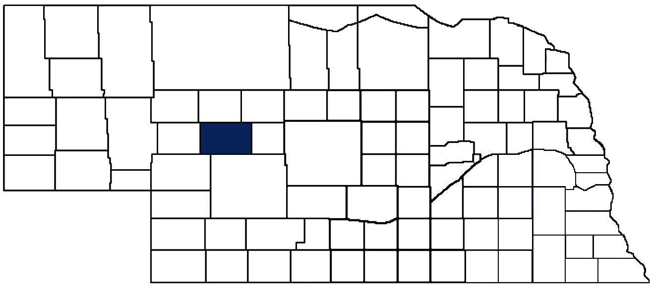
McPherson County Seat: Tryon
Total County Population: 399
- Municipalities: None
- Unincorporated Pop. (% of county pop.): 399 (100%) 2020
Land Development (% of total land in county):
- Agriculture: 99%
- By method: Pasture (pure grassland) (96%); Irrigated (row crop/grain/forage) (3%); Dryland (row crop/grain/forage) (0.33%) • Neb. Dept. of Rev. - total equals agriculture's %
- By commodity: Livestock (grassland) 95%, Corn 1%, Sorghum 0.5%, Alfalfa 0.5% • USDA - equals agriculture's % plus some wetlands (2%) and minus public grassland/wetlands and reserve
- Residential, Commercial, Industrial, Conservation Reserve & Exempt (combined): 1% 2022
County Offices
Courthouse Address and Hours:
500 Anderson Street
Tryon, Nebraska 69167
M-F 8:30 am - 12:00 pm; 1:00 pm - 4:30pm
Complete list of county board members
County Board Meetings: 2nd Wednesday
View the County's Government Maps
NACO District: West Central
West Central District Officers
General
Population: 399
Land area (sq. mi.): 859.26
Population per square mile: 0.5
Race and Age
Race 2020
White: 94.7%
African American: 0.0%
American Indian: 1.0%
Asian: 0.5%
Hispanic: 0.8%
Native Hawaiian and Pacific Islander: 0.0%
Two or More Races: 2.8%
Age 2020
0-17: 17.9%
18-64: 55.4%
65+: 26.6%
Households
Total households: 168 2020
With one child: 20 2022
With 2+ children: 20 2022
With seniors (65+): 50 2022
Socioeconomics
Median household income: $64,637 2023
% of Population in Poverty: 15.1% 2023
# of Housing Units: 232 2020
Owner-occupied rate: 72.0% 2020
Median home price: $134,350 Q4 2024
2024 building permits for detached single family homes: 1
2024 building permits for non-detached housing units: 0 (townhouse, duplex, or apt. unit)
Technology
Access to broadband (100 Mbps via fiber or cable modem): 60.3% 2021
Sources: National Association of Realtors, Nebraska Department of Revenue, Nebraska Legislature, Nebraska Library Commission, U.S. Bureau of Economic Analysis, U.S. Census Bureau (building permits), U.S. Census Bureau (demographics), U.S. Census Bureau (municipalities)
Employment, Schools, and Child Care
Unemployment rate: 3.5% March 2025
County Employment Website: https://mcphersoncounty.ne.gov/webpages/links/public_notices.html
High school graduate or higher: 90.8% 2020
Bachelor's degree or higher: 23.7% 2020
School Districts: Arthur County Schools, McPherson County Schools, Stapleton Public Schools
McPherson County Economy
Annual Gross Domestic Product (GDP): $38,493,000 2023
Nonfarm Small Business Receipts: $6,166,515 2022
Nonfarm Wage Income: $5,788,000 2022
Farm and Ranch Commodity Sales Receipts: $44,372,000 2022
Farm and Ranch Operations (Non-Sales) Receipts: $1,746,000 2022
- For components of nonfarm small business receipts, nonfarm wage income, and farm & ranch commodity sales and operations receipts, see "Notes" below.
Local Grain Market: Click for today's grain prices in McPherson County
Cattle Producers: 75
- Pastureland Cash Rent (avg.): $20/acre 2024
Crop Producers: 32
- Irrigated Land Cash Rent (avg.): $172/acre 2024
Electricity Providers: Custer PPD, PREMA
Irrigation and Drinking Water
Rural Irrigation Wells: 128 2024
Rural Livestock Wells: 562 2024
Rural Commercial/Industrial Wells: 0 2024
Rural Drinking Water Wells: 44 2024
Drinking Water Utility Connections: 0 2024
Surface Water Diversions (Irrigation): 1 2024
Click for real time:
Groundwater level data near NE Hwy 92 & Snyder Dr. (10.5 mi. west of Tryon)
Notes
McPherson County Economy
- Nonfarm small business receipts are reported by partnerships and sole proprietorships. They do not include receipts reported by cooperative associations.
- Nonfarm wage income is reported based upon the wage earner's residential address; therefore, it also includes wages earned by McPherson County residents in other counties or states, but it excludes wages earned in McPherson County by residents of other counties or states.
- Nonfarm wage income excludes wages earned by anyone claimed as a dependent.
- Farm and ranch commodity sales receipts and operations receipts are reported based upon the farm or ranch owner's principal county of operations; therefore, those figures also include receipts reported by producers operating principally in McPherson County for their production in other counties or states, but the figures exclude receipts reported for production in McPherson County by producers operating principally in other counties or states.
Irrigation and Drinking Water
- A rural irrigation well is any well intended for irrigating crops that, either on its own or as part of a set of commingled wells, is capable of pumping more than fifty (50) gallons of water per minute (gpm). Note that some rural commercial/industrial wells are also capable of pumping more than 50 gpm. In Nebraska, the owner of any well--or set of commingled wells--that is capable of pumping more than 50 gpm must register the well(s) with the state government and have a permit for the well(s) from the local natural resource district (NRD).
- Rural livestock wells and rural drinking water (also known as "domestic") wells are not allowed to pump more than 50 gpm unless permitted by the local NRD. Each rural drinking water well usually serves one single family home, though in rare cases a rural drinking water well serves multiple homes.
- Data on rural livestock wells and rural drinking water wells may be incomplete for wells drilled prior to September 9, 1993. State law does not require wells drilled prior to that date to be registered with the state government if the wells are not capable of pumping more than 50 gpm. Neb. Rev. Stat. § 46-735; see Laws 1993, LB 131, § 25.
Sources: National Agricultural Statistics Service (USDA), Nebraska Cooperative Council, Nebraska Coordinating Commission for Postsecondary Education, Nebraska Department of Health and Human Services, Nebraska Department of Revenue, Nebraska Department of Transportation, Nebraska Office of the CIO, Nebraska Power Review Board, Nebraska Public Service Commission, U.S. Bureau of Economic Analysis, U.S. Bureau of Labor Statistics, U.S. Census Bureau, U.S. Energy Information Administration, U.S. Department of the Treasury (IRS), Warehouse and Commodity Management Division (USDA)
2024 Levies and Valuation
County levy rate: $0.2426 per $100 of taxable valuation
County property taxes levied: $954,980
Total local government property taxes levied: $3,946,385
Total countywide taxable valuation: $393,635,513
Federal PILT payment to McPherson County (FY2024): $134 regarding 40 federally-owned acres
Click here for all levy rates in McPherson County
County Levy and Taxation Laws
Levy limits
Since 1996, counties and other political subdivisions have been subject to the levy limits listed in Neb. Rev. Stat. § 77-3442 and Neb. Rev. Stat. § 77-3443.
Statutes and regulations
Nebraska Revised Statutes (Chapter 77)
Nebraska Administrative Code (Title 350)
Local tax reductions, exemptions, and credits
Neb. Rev. Stat. § 76-902(5)(a) (Deed "stamp tax" exemption): "The [stamp tax] shall not apply to: ... (5)(a) Deeds between spouses, between ex-spouses for the purpose of conveying any rights to property acquired or held during the marriage, or between parent and child, without actual consideration therefor."
Neb. Rev. Stat. § 77-201(2) (Valuation of agricultural land and horticultural land): "Agricultural land and horticultural land as defined in section 77-1359 shall constitute a separate and distinct class of property for purposes of property taxation, shall be subject to taxation, unless expressly exempt from taxation, and shall be valued at seventy-five percent of its actual value, except that for school district taxes levied to pay the principal and interest on bonds that are approved by a vote of the people on or after January 1, 2022, such land shall be valued at fifty percent of its actual value."
Neb. Rev. Stat. § 77-6703(1) (Tax credit for school district taxes paid): "(1) For taxable years beginning or deemed to begin on or after January 1, 2020, under the Internal Revenue Code of 1986, as amended, there shall be allowed to each eligible taxpayer a refundable credit against the income tax imposed by the Nebraska Revenue Act of 1967 or against the franchise tax imposed by sections 77-3801 to 77-3807. The credit shall be equal to the credit percentage for the taxable year, as set by the department under subsection (2) of this section, multiplied by the amount of school district taxes paid by the eligible taxpayer during such taxable year."
Sources: Nebraska Department of Revenue
State Senator: Mike Jacobson (District 42)
Committees
- Banking, Commerce and Insurance
- Revenue
- Committee On Committees
- Reference
- Executive Board
- Legislative Performance Audit
- Statewide Tourism And Recreational Water Access and Resource Sustainability (LB406)
Map and statistics for Legislative District 42
Map of all districts in the Nebraska Unicameral Legislature

McPherson County History
Number of Registered Historic Places: 0
Year Authorized: 1890
Year Organized: 1890
Etymology: James McPherson (U.S. army general)
In 1887, the Legislature established McPherson County from the last remaining unorganized Nebraska territory. Before Arthur County seceded, the county stretched all the way west to present-day Garden County. Unlike many other newly organized counties, McPherson County was a late-bloomer, growing by only one hundred residents over two decades. However, following the passage of the Kinkaid Act in 1904, the county grew from around 500 residents to its largest population of nearly 2,500 people. The Kinkaid Act was intended to enhance the Homestead Act of 1862 by allowing homesteaders to file and obtain a patent after five years on a full section of land (640 acres) instead of the previously allowed quarter-section (160 acres).
By 1910, the county seat of Tryon was booming, serving as a major regional hub in the Sandhills. While other counties experiencing infighting among larger, more established ranches and newly arrived “Kinkaiders,” McPherson County witnessed a camaraderie among ranchers and pioneers from all walks. This may have been due to the fact that most county residents had only themselves to count on—the county did not own any railroad property for revenue and the levies were mainly born by the larger ranches.
The goodwill did not last. Residents of western McPherson County continued their calls to move the county seat from Tryon to the more centrally located Flats, but the heavily populated eastern side of McPherson County repeatedly voted down ballot initiatives. The infamous “Pauly Jail cells purchase” of 1912 finally prompted secessionist action. According to historical accounts, the cells cost the county $1,300 while the entire building that housed them cost only $180. Western county residents initiated legal proceedings that culminated in the creation of Arthur County in 1913.
Today, ranching and farming continue to drive McPherson County’s economy, and Tryon still remains one of only two unincorporated county seats (Banner County’s seat of Harrisburg is the other). The county’s early spirit of self-reliance, kinship, and industriousness continue to characterize this tight-knit community.
McPherson County Excellence:
Throughout the year, McPherson County Sheriff Thomas Burch and his deputy frequently assist local cattle producers during cattle drives. When producers move cattle around the county, the Sheriff's Department follows the herd and places lights on the herd which protect the cattle and local motorists.
Cattle form an important part of McPherson County's economy, with at least 75 local producers responsible for 41,000 cattle and calves in 2022, according to the USDA.
Local Highlights
License Plate Number: 90
Time Zone: Central
Number of Veterans: 29 2023
Zoned County: Yes
Election Data
General Election Turnout: 84% 2024
Total Registered Voters: 344 2024
Number of Precincts: 1 2022
Number of Election Day Polling Places: 1 2022
Land Area per Polling Place (avg.): 575.45 sq. miles
Intergovernmental Data
Emergency Mgt. Planning, Exercise and Training (PET) Region: North Central/Sandhills
Natural Resource Districts: Upper Loup NRD, Twin Platte NRD
Sources: Nebraska Department of Transportation, Nebraska Emergency Management Agency, Nebraska Game & Parks Commission, Nebraska Legislature, Nebraska Office of the CIO, Nebraska Secretary of State, U.S. Department of Veterans Affairs, U.S. Election Assistance Commission, U.S. National Archives and Records Administration (eCFR)