- General Info
- Demographics
- Education and Employment
- Valuation and Taxes Levied
- State Senators
- History
- County Programs
- Other Information
Communities and Development
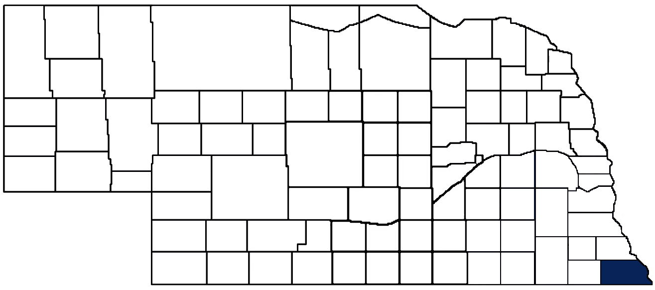
Richardson County Seat: Falls City
Total County Population: 7,871
- Cities (pop. & class): Falls City (4,133 • 2nd Class), Humboldt (800 • 2nd Class)
- Villages (pop.): Barada (21), Dawson (148), Preston (19), Rulo (145), Salem (83), Shubert (163), Stella (145), Verdon (164)
- Unincorporated Pop. (% of county pop.): 2,050 (26%) 2020
Land Development (% of total land in county):
- Agriculture: 78%
- By method: Dryland (row crop/grain/forage) (62%); Pasture (pure grassland) (12%); Irrigated (row crop/grain/forage) (3%) • Neb. Dept. of Rev. - total equals agriculture's %
- By commodity: Corn 33%, Soybeans 33%, Livestock (grassland) 16%, Other Hay 1%, Alfalfa 1% • USDA - equals agriculture's % plus some wetlands (2%) and minus public grassland/wetlands and reserve
- Residential, Commercial, Industrial, Conservation Reserve & Exempt (combined): 13%
- Timber: 9% 2022
County Offices
Courthouse Address and Hours:
1700 Stone Street
Falls City, Nebraska 68355
M-F 8:00 am - 5:00 pm
Complete list of county board members
County Board Meetings: Wednesday
View the County's Government Maps
NACO District: Southeast
Click for a live look at Richardson County (south of Dawson)
General
Population: 7,871
Land area (sq. mi.): 551.84
Population per square mile: 14.3
Race and Age
Race 2020
White: 90.2%
African American: 0.2%
American Indian: 2.8%
Asian: 0.4%
Hispanic: 2.0%
Native Hawaiian and Pacific Islander: 0.0%
Two or More Races: 4.3%
Age 2020
0-17: 22.0%
18-64: 53.7%
65+: 24.3%
Households
Total households: 3,460 2020
With one child: 360 2022
With 2+ children: 530 2022
With seniors (65+): 990 2022
Socioeconomics
Median household income: $55,578 2023
% of Population in Poverty: 12.8% 2023
# of Housing Units: 4,083 2020
Owner-occupied rate: 75.9% 2020
Median home price: $104,390 Q4 2024
2024 building permits for detached single family homes: 3
2024 building permits for non-detached housing units: 14 (townhouse, duplex, or apt. unit)
Technology
Access to broadband (100 Mbps via fiber or cable modem): 89.9% 2021
Sources: National Association of Realtors, Nebraska Department of Revenue, Nebraska Legislature, Nebraska Library Commission, U.S. Bureau of Economic Analysis, U.S. Census Bureau (building permits), U.S. Census Bureau (demographics), U.S. Census Bureau (municipalities)
Employment, Schools, and Child Care
Unemployment rate: 2.6% March 2025
County Employment Website: https://co.richardson.ne.us/webpages/links/public_notices.html
High school graduate or higher: 93.0%
School Districts: Auburn Public Schools, Falls City Public Schools, Humboldt Table Rock Steinauer, Johnson-Brock Public Schools, Pawnee City Public Schools
Bachelor's degree or higher: 18.8%
Community College Service Area: Southeast Community College
Countywide child care capacity: 15 providers; 253 children
Find child care: For a list of child care providers in your zip code, visit Nebraska DHHS or the Nebraska Resource and Referral System.
Richardson County Economy
Annual Gross Domestic Product (GDP): $493,287,000 2023
Nonfarm Small Business Receipts: $45,784,230 2022
Nonfarm Wage Income: $146,034,000 2022
Farm and Ranch Commodity Sales Receipts: $232,024,000 2022
Farm and Ranch Operations (Non-Sales) Receipts: $11,146,000 2022
- For components of nonfarm small business receipts, nonfarm wage income, and farm & ranch commodity sales and operations receipts, see "Notes" below.
Grain Elevators by Location (bushel capacity):
- Falls City: CGB (2,227,000)
- Humboldt: Farmers (733,743)
- Rulo: Ag Partners (351,000)
- (1 bushel = 56 lbs. corn/sorghum, 60 lbs. soybeans/wheat; % max. moisture = 18% beans, 15.5% corn, 14% sorghum/soybeans, 13.5% wheat)
Railroad Miles: 58.37 main, 17.73 side
- Places with Railroad Service: Dawson, Falls City, Humboldt, Preston, Rulo, Salem, Stella, Verdon
Local Grain Market: Click for today's grain prices in Richardson County
Cattle Producers: 218
- Pastureland Cash Rent (avg.): $52/acre 2024
Crop Producers: 49
- Dryland Cash Rent (avg.): $210/acre 2024
Dairy Producers: 3
Farmers Market: Falls City Farmers Market (May - September, Thursdays 4:00 - 6:00 p.m.)
Oil Wells Producing (barrels of oil/yr): 92 wells (76,832 barrels)
Electricity Providers: Auburn Board of Public Works, City of Falls City, Nebraska PPD, Omaha PPD
Wind Turbines Operating (MW): 40 turbines (60,000 MW total)
Irrigation and Drinking Water
Rural Irrigation Wells: 94 2024
Rural Livestock Wells: 20 2024
Rural Commercial/Industrial Wells: 2 2024
Rural Drinking Water Wells: 207 2024
Drinking Water Utility Connections: 3,468 Residential; 437 Commercial; 5 Industrial 2024
Surface Water Diversions (Irrigation): 159 2024
Click for real time:
Streamflow data on the Missouri River at Rulo
Streamflow data on the North Fork of the Big Nemaha River at Humboldt
Streamflow data on the Big Nemaha River at Falls City
Notes
Richardson County Economy
- Nonfarm small business receipts are reported by partnerships and sole proprietorships. They do not include receipts reported by cooperative associations.
- Nonfarm wage income is reported based upon the wage earner's residential address; therefore, it also includes wages earned by Richardson County residents in other counties or states, but it excludes wages earned in Richardson County by residents of other counties or states.
- Nonfarm wage income excludes wages earned by anyone claimed as a dependent.
- Farm and ranch commodity sales receipts and operations receipts are reported based upon the farm or ranch owner's principal county of operations; therefore, those figures also include receipts reported by producers operating principally in Richardson County for their production in other counties or states, but the figures exclude receipts reported for production in Richardson County by producers operating principally in other counties or states.
Irrigation and Drinking Water
- A rural irrigation well is any well intended for irrigating crops that, either on its own or as part of a set of commingled wells, is capable of pumping more than fifty (50) gallons of water per minute (gpm). Note that some rural commercial/industrial wells are also capable of pumping more than 50 gpm. In Nebraska, the owner of any well--or set of commingled wells--that is capable of pumping more than 50 gpm must register the well(s) with the state government and have a permit for the well(s) from the local natural resource district (NRD).
- Rural livestock wells and rural drinking water (also known as "domestic") wells are not allowed to pump more than 50 gpm unless permitted by the local NRD. Each rural drinking water well usually serves one single family home, though in rare cases a rural drinking water well serves multiple homes.
- Data on rural livestock wells and rural drinking water wells may be incomplete for wells drilled prior to September 9, 1993. State law does not require wells drilled prior to that date to be registered with the state government if the wells are not capable of pumping more than 50 gpm. Neb. Rev. Stat. § 46-735; see Laws 1993, LB 131, § 25.
Sources: National Agricultural Statistics Service (USDA), Nebraska Cooperative Council, Nebraska Coordinating Commission for Postsecondary Education, Nebraska Department of Health and Human Services, Nebraska Department of Revenue, Nebraska Department of Transportation, Nebraska Office of the CIO, Nebraska Power Review Board, Nebraska Public Service Commission, U.S. Bureau of Economic Analysis, U.S. Bureau of Labor Statistics, U.S. Census Bureau, U.S. Energy Information Administration, U.S. Department of the Treasury (IRS), Warehouse and Commodity Management Division (USDA)
2024 Levies and Valuation
County levy rate: $0.3271 per $100 of taxable valuation
County property taxes levied: $5,985,414
Total local government property taxes levied: $20,911,531
Total countywide taxable valuation: $1,829,659,741
Federal PILT payment to Richardson County (FY2024): $1,379 regarding 412 federally-owned acres
Click here for all levy rates in Richardson County
County Levy and Taxation Laws
Levy limits
Since 1996, counties and other political subdivisions have been subject to the levy limits listed in Neb. Rev. Stat. § 77-3442 and Neb. Rev. Stat. § 77-3443.
Statutes and regulations
Nebraska Revised Statutes (Chapter 77)
Nebraska Administrative Code (Title 350)
Local tax reductions, exemptions, and credits
Neb. Rev. Stat. § 76-902(5)(a) (Deed "stamp tax" exemption): "The [stamp tax] shall not apply to: ... (5)(a) Deeds between spouses, between ex-spouses for the purpose of conveying any rights to property acquired or held during the marriage, or between parent and child, without actual consideration therefor."
Neb. Rev. Stat. § 77-201(2) (Valuation of agricultural land and horticultural land): "Agricultural land and horticultural land as defined in section 77-1359 shall constitute a separate and distinct class of property for purposes of property taxation, shall be subject to taxation, unless expressly exempt from taxation, and shall be valued at seventy-five percent of its actual value, except that for school district taxes levied to pay the principal and interest on bonds that are approved by a vote of the people on or after January 1, 2022, such land shall be valued at fifty percent of its actual value."
Neb. Rev. Stat. § 77-6703(1) (Tax credit for school district taxes paid): "(1) For taxable years beginning or deemed to begin on or after January 1, 2020, under the Internal Revenue Code of 1986, as amended, there shall be allowed to each eligible taxpayer a refundable credit against the income tax imposed by the Nebraska Revenue Act of 1967 or against the franchise tax imposed by sections 77-3801 to 77-3807. The credit shall be equal to the credit percentage for the taxable year, as set by the department under subsection (2) of this section, multiplied by the amount of school district taxes paid by the eligible taxpayer during such taxable year."
Sources: Nebraska Department of Revenue
State Senator: Robert Hallstrom (District 1)
Committees
Map and statistics for Legislative District 1
Map of all districts in the Nebraska Unicameral Legislature

Richardson County History
Number of Registered Historic Places: 12
Year Authorized: 1854
Year Organized: 1855
Etymology: William Richardson (Nebraska Territory governor)
Richardson County was among the eight original counties to comprise the Nebraska Territory in 1854. Located along the Missouri River in the far southeast corner of the state, the county was officially organized the following year by the Territorial Legislature and named after William A. Richardson of Illinois, who would serve as Nebraska's fourth territorial governor in 1858.
In the early years the area of Richardson County included what is today Pawnee County. But public sentiment in the western part of the county began to develop about creating a separate unit of government, primarily because most the of county offices were held by men living in the eastern part of the county. In 1856 the area was divided into two counties.
Embedded deep in the history of Richardson County is the famous John Brown's Underground Railroad, a secret network of cooperation which aided slaves in reaching sanctuary in the free states and Canada. Several of the network's stations were set up in this area. Ann Dorrington was one of the area's residents who befriended those fleeing slavery. Her kindness and compassion led to her being known as "Mother" Dorrington.
Falls City would officially become the county seat in 1871, a full 16 years after the county was organized. This brought to an end a hotly-contested campaign that Falls City and Salem were embroiled in for more than a decade.
In 1872 a proposal to issue $25,000 in bonds to build a stone and brick courthouse did not meet with the approval of the county's voters. The following year the proposal was scaled back to $15,000 and this time it was successful. The courthouse that was built would stand until May 1919, when it was destroyed by fire.
The following July an election was held to levy five mills on the county's valuation for the purpose of building a new courthouse. Although voters approved the levy, construction on the present courthouse did not begin until 1924.
Highlight an important program in your county in this space! Send an email to:
Local Highlights
License Plate Number: 19
Time Zone: Central
Number of Veterans: 578 2023
Zoned County: No
Number of County-Owned Bridges: 201
Number of County-Owned Dams: 1
Election Data
General Election Turnout: 77% 2024
Total Registered Voters: 5,236 2024
Number of Precincts: 15 2022
Number of Election Day Polling Places: 10 2022
Land Area per Polling Place (avg.): 55.46 sq. miles
Intergovernmental Data
Emergency Mgt. Planning, Exercise and Training (PET) Region: Southeast
Natural Resource District: Nemaha NRD
State Lands (acres): Four-Mile Creek WMA (108.80), Indian Cave State Park (3,399.70), Kinter's Ford WMA (199.06), Margrave WMA (106.09), South Fork WMA (277.53), Thomas C. Matter WMA (145), Verdon SRA (74.66)
Federal Lands (acres): Cottier Bend (388)
Sources: Nebraska Department of Transportation, Nebraska Emergency Management Agency, Nebraska Game & Parks Commission, Nebraska Legislature, Nebraska Office of the CIO, Nebraska Secretary of State, U.S. Department of Veterans Affairs, U.S. Election Assistance Commission, U.S. National Archives and Records Administration (eCFR)