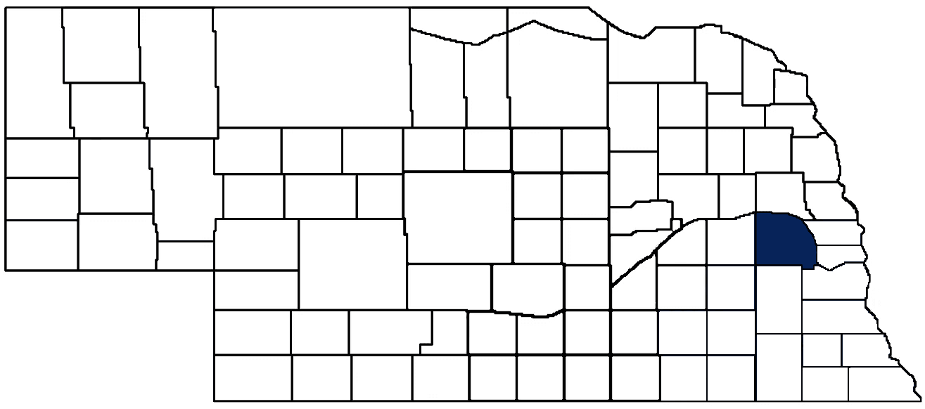
- General Info
- Demographics
- Education and Employment
- Valuation and Taxes Levied
- State Senators
- History
- County Programs
- Other Information
Communities and Development
Saunders County Seat: Wahoo
Total County Population (2020): 22,278
- Cities (pop. & class): Ashland (3,086 • 2nd Class), Wahoo (4,818 • 2nd Class), Yutan (1,347 • 2nd Class)
- Villages (pop.): Cedar Bluffs (615), Ceresco (919), Colon (107), Ithaca (160), Malmo (94), Mead (617), Memphis (109), Morse Bluff (117), Prague (291), Valparaiso (595), Weston (250)
- Unincorporated Pop. (% of county pop.): 9,045 (41%)
Land Development (2022) (% of total land in county):
- Agriculture: 89%
- By method: Pasture (pure grassland) (6%); Dryland (row crop/grain/forage) (51%); Irrigated (row crop/grain/forage) (23%) • Neb. Dept. of Rev. - total equals agriculture's %
- By commodity: Corn 40%, Soybeans 36%, Livestock (grassland) 10%, Other Hay 2%, Alfalfa 2% • USDA - equals agriculture's % plus some wetlands (1%) and minus public grassland/wetlands and reserve
- Residential, Commercial, Industrial, Conservation Reserve & Exempt (combined): 17%
- Timber: 3%
County Offices
Courthouse Address and Hours:
433 North Chestnut
Wahoo, Nebraska 68066
M-F 8:00 am - 4:30 pm
Complete list of county board members
County Board Meetings: First 4 Tuesdays
View the County's Government Maps
NACO District: Southeast
General
Population: 22,278
Land area (sq. mi.): 784.93
Population per square mile: 29.7
Race and Age
Race 2020
White: 92.9%
African American: 0.3%
American Indian: 0.3%
Asian: 0.4%
Hispanic: 2.6%
Native Hawaiian and Pacific Islander: 0.0%
Two or More Races: 3.0%
Age 2020
0-17: 25.1%
18-64: 56.6%
65+: 18.3%
Households
Total households: 8,667 2020
With one child: 960 2022
With 2+ children: 1,600 2022
With seniors (65+): 2,310 2022
Socioeconomics
Personal income per capita: $89,395 2023
% of Population in Poverty: 7.4% 2023
# of Housing Units: 9,987 2020
Owner-occupied rate: 79.6% 2020
Median home price: $252,270 Q4 2024
2024 building permits for detached single family homes: 128
2024 building permits for non-detached housing units: 10 (townhouse, duplex, or apt. unit)
Technology
Access to broadband (100 Mbps via fiber or cable modem): 66.7% 2021
Sources: National Association of Realtors, Nebraska Department of Revenue, Nebraska Legislature, Nebraska Library Commission, U.S. Bureau of Economic Analysis, U.S. Census Bureau (building permits), U.S. Census Bureau (demographics), U.S. Census Bureau (municipalities)
Employment, Schools, and Child Care
Unemployment rate: 2.2% March 2025
County Employment Website: https://saunderscounty.ne.gov/webpages/about/employment.html
High school graduate or higher: 90.9% 2020
School Districts: Ashland-Greenwood Public Schools, Cedar Bluffs Public Schools, David City Public Schools, East Butler Public Schools, Fremont Public Schools, Gretna Public Schools, Mead Public Schools, North Bend Central Public Schools, Raymond Central Public Schools, Schuyler Community Schools, Wahoo Public Schools, Waverly School District 145, Yutan Public Schools
Bachelor's degree or higher: 25.6% 2020
Community College Service Area: Southeast Community College
Countywide child care capacity: 36 providers; 1,221 children 2024
Find child care: For a list of child care providers in your zip code, visit Nebraska DHHS or the Nebraska Resource and Referral System.
Saunders County Economy
Annual Gross Domestic Product (GDP): $1,100,460,000 2023
Nonfarm Small Business Receipts: $195,193,700 2022
Nonfarm Wage Income: $688,280,000 2022
Farm and Ranch Commodity Sales Receipts: $514,932,000 2022
Farm and Ranch Operations (Non-Sales) Receipts: $18,511,000 2022
- For components of nonfarm small business receipts, nonfarm wage income, and farm & ranch commodity sales and operations receipts, see "Notes" below.
Ethanol Plants (annual production capacity): Chief Ethanol Fuels (55 million gallons)
Grain Elevators by Location (bushels capacity):
- Ceresco: Frontier (3,276,953)
- Colon: Colon Elevator (496,636)
- Mead: Frontier (6,770,343)
- Prague: Frontier (990,403)
- Wahoo: Elkhorn Valley (791,000), Frontier (758,737)
- Weston: Frontier (665,409)
- 1 bushel = 56 lbs. corn/sorghum, 60 lbs. soybeans/wheat; % max. moisture = 18% beans, 15.5% corn, 14% sorghum/soybeans, 13.5% wheat
Railroad Miles: 44.94 main, 8.18 side
- Places with Railroad Service: Leshara, Mead, Valparaiso, Wahoo, Weston, Yutan
Local Grain Market: Click for today's grain prices in Saunders County
Cattle Producers: 240
- Pastureland Cash Rent (avg.): $53/acre 2024
Crop Producers: 262
- Dryland Cash Rent (avg.): $224/acre 2024
- Irrigated Land Cash Rent (avg.): $309/acre 2024
Dairy Producers: 1
Farmers Markets:
- Downtown Fremont Market (Mid-July - End of September, Thursdays)
- Valparaiso Farmers Market (June - October, Saturdays 9:00 - 11:00 a.m.)
- Wahoo Farmers Market (June - October, Saturdays 8:00 a.m. - 1:00 p.m.)
Electricity Providers: Butler PPD, City of Wahoo, Omaha PPD, Village of Prague
Irrigation and Drinking Water
Rural Irrigation Wells: 1,095 2024
Rural Livestock Wells: 52 2024
Rural Commercial/Industrial Wells: 21 2024
Rural Drinking Water Wells: 1,500 2024
Drinking Water Utility Connections: 5,622 Residential; 628 Commercial; 4 Industrial 2024
Surface Water Diversions (Irrigation): 128 2024
Click for real time:
Streamflow data on the Platte River near Venice
Streamflow data on North Oak Creek near Touhy
Streamflow data on North Oak Creek at Valparaiso
Streamflow data on Wahoo Creek at Ithaca
Streamflow data on Wahoo Creek at Ashland
Streamflow data on Salt Creek near Ashland
Notes
Saunders County Economy
- Nonfarm small business receipts are reported by partnerships and sole proprietorships. They do not include receipts reported by cooperative associations.
- Nonfarm wage income is reported based upon the wage earner's residential address; therefore, it also includes wages earned by Saunders County residents in other counties or states, but it excludes wages earned in Saunders County by residents of other counties or states.
- Nonfarm wage income excludes wages earned by anyone claimed as a dependent.
- Farm and ranch commodity sales receipts and operations receipts are reported based upon the farm or ranch owner's principal county of operations; therefore, those figures also include receipts reported by producers operating principally in Saunders County for their production in other counties or states, but the figures exclude receipts reported for production in Saunders County by producers operating principally in other counties or states.
Irrigation and Drinking Water
- A rural irrigation well is any well intended for irrigating crops that, either on its own or as part of a set of commingled wells, is capable of pumping more than fifty (50) gallons of water per minute (gpm). Note that some rural commercial/industrial wells are also capable of pumping more than 50 gpm. In Nebraska, the owner of any well--or set of commingled wells--that is capable of pumping more than 50 gpm must register the well(s) with the state government and have a permit for the well(s) from the local natural resource district (NRD).
- Rural livestock wells and rural drinking water (also known as "domestic") wells are not allowed to pump more than 50 gpm unless permitted by the local NRD. Each rural drinking water well usually serves one single family home, though in rare cases a rural drinking water well serves multiple homes.
- Data on rural livestock wells and rural drinking water wells may be incomplete for wells drilled prior to September 9, 1993. State law does not require wells drilled prior to that date to be registered with the state government if the wells are not capable of pumping more than 50 gpm. Neb. Rev. Stat. § 46-735; see Laws 1993, LB 131, § 25.
Sources: National Agricultural Statistics Service (USDA), Nebraska Cooperative Council, Nebraska Coordinating Commission for Postsecondary Education, Nebraska Department of Health and Human Services, Nebraska Department of Revenue, Nebraska Department of Transportation, Nebraska Office of the CIO, Nebraska Power Review Board, Nebraska Public Service Commission, U.S. Bureau of Economic Analysis, U.S. Bureau of Labor Statistics, U.S. Census Bureau, U.S. Energy Information Administration, U.S. Department of the Treasury (IRS), Warehouse and Commodity Management Division (USDA)
2024 Levies and Valuation
County levy rate: $0.2160 per $100 of taxable valuation
County property taxes levied: $12,026,691
Total local government property taxes levied: $75,635,941
Total countywide taxable valuation: $5,567,290,017
Click here for all levy rates in Saunders County
County Levy and Taxation laws
Levy limits
Since 1996, counties and other political subdivisions have been subject to the levy limits listed in Neb. Rev. Stat. § 77-3442 and Neb. Rev. Stat. § 77-3443.
Statutes and regulations
Nebraska Revised Statutes (Chapter 77)
Nebraska Administrative Code (Title 350)
Local tax reductions, exemptions, and credits
Neb. Rev. Stat. § 76-902(5)(a) (Deed "stamp tax" exemption): "The [stamp tax] shall not apply to: ... (5)(a) Deeds between spouses, between ex-spouses for the purpose of conveying any rights to property acquired or held during the marriage, or between parent and child, without actual consideration therefor."
Neb. Rev. Stat. § 77-201(2) (Valuation of agricultural land and horticultural land): "Agricultural land and horticultural land as defined in section 77-1359 shall constitute a separate and distinct class of property for purposes of property taxation, shall be subject to taxation, unless expressly exempt from taxation, and shall be valued at seventy-five percent of its actual value, except that for school district taxes levied to pay the principal and interest on bonds that are approved by a vote of the people on or after January 1, 2022, such land shall be valued at fifty percent of its actual value."
Neb. Rev. Stat. § 77-6703(1) (Tax credit for school district taxes paid): "(1) For taxable years beginning or deemed to begin on or after January 1, 2020, under the Internal Revenue Code of 1986, as amended, there shall be allowed to each eligible taxpayer a refundable credit against the income tax imposed by the Nebraska Revenue Act of 1967 or against the franchise tax imposed by sections 77-3801 to 77-3807. The credit shall be equal to the credit percentage for the taxable year, as set by the department under subsection (2) of this section, multiplied by the amount of school district taxes paid by the eligible taxpayer during such taxable year."
Sources: Nebraska Department of Revenue
State Senator: Jared Storm (District 23)
Committees
Map and statistics for Legislative District 23
Map of all districts in the Nebraska Unicameral Legislature

Saunders County History
Number of Registered Historic Places: 22
Year Authorized: 1856
Year Organized: 1867
Etymology: Alvin Saunders (Nebraska Territory governor)
Saunders County was created by the Territorial Legislature on Jan. 26, 1856 and at that time was named Calhoun County. But the name Calhoun was not popular among early settlers in the territory, as a government surveyor by that name was suspected of corruption and graft. So in 1862 the Territorial Legislature changed the county's name to Saunders, in honor of territorial Gov. Alvin Saunders.
Ashland is believed to be the first settlement in the county. For many years the area stretching north along the Platte River from Ashland to Leshara was home to the Otoe Indians, while the Pawnee Indians were camped in the bluffs in the northern part of the county.
When the first county election was held in 1866, the settlement of Ashland was chosen as the county seat. In 1870 the county's first courthouse would be built here. Ashland's status as home to this new county's government would be short-lived, however, as in 1873 voters chose a more centrally located Wahoo. Within a year a courthouse would be built in the new county seat and stand for the next 30 years. By the beginning of the 20th century the county was in need of a new home for its offices and in 1904 the present courthouse was built at a cost of $87,000.
Located on the east lawn of the courthouse today is a replica of a Mark 14 torpedo, which stands as a memorial to the U.S.S. Wahoo and its crew of 65 who perished during World War II. The submarine was credited with sinking 20 Japanese ships before it was sunk by enemy action on Oct. 11, 1943. Each October a memorial service is held at the courthouse to honor those who gave their lives in submarine warfare.
A frequently-asked question is how the county seat received its unique name. There are actually two versions that are used to provide the answer. The first is that the name originates from an Indian word for a medicinal plant known as the "burning bush," which grew along the banks of the Wahoo Creek. The second explanation is the name is from the word "pahoo," which means "not very bluffy" terrain.
Highlight an important program in your county in this space! Send an email to:
Local Highlights
License Plate Number: 6
Time Zone: Central
Number of Veterans: 1,380 2023
Zoned County: Yes
Number of County-Owned Bridges: 449
Number of County-Owned Dams: 5
Election Data
General Election Turnout: 83% 2024
Total Registered Voters: 16,705 2024
Number of Precincts: 19 2022
Number of Election Day Polling Places: 19 2022
Land Area per Polling Place (avg.): 44.05 sq. miles
Intergovernmental Data
Emergency Mgt. Planning, Exercise and Training (PET) Region: East Central
Natural Resource Districts: Lower Platte North NRD, Lower Platte South NRD
State Lands (acres): Bramble WMA (93.10 Dodge & Saunders), Catfish Run WMA (21.18), Eastern Nebraska Research, Extension and Education Center (9,500), Jack Sinn Memorial WMA (1,615.72), Larkspur WMA (160), Memphis Lake SRA (130), Memphis Lake WMA (92), Two Rivers SRA (621.92 Douglas & Saunders), Two Rivers WMA (342 Douglas & Saunders)
Sources: Nebraska Department of Transportation, Nebraska Emergency Management Agency, Nebraska Game & Parks Commission, Nebraska Legislature, Nebraska Office of the CIO, Nebraska Secretary of State, U.S. Department of Veterans Affairs, U.S. Election Assistance Commission, U.S. National Archives and Records Administration (eCFR)