- General Info
- Demographics
- Education and Employment
- Valuation and Taxes Levied
- State Senators
- History
- County Programs
- Other Information
Communities and Development
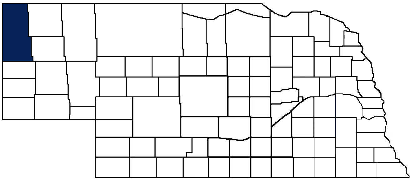
Sioux County Seat (pop.): Harrison (239)
Total County Population: 1,135
- Villages (pop.): Harrison (239)
- Unincorporated Pop. (% of county pop.): 896 (79%) 2020
Land Development (% of total land in county):
- Agriculture: 82%
- By method: Pasture (pure grassland) (76%); Irrigated (row crop/grain/forage) (3%); Dryland (row crop/grain/forage) (3%) • Neb. Dept. of Rev. - total equals agriculture's %
- By commodity: Livestock (grassland) 90%, Alfalfa 2%, Corn 1%, Other Hay 1% • USDA - equals agriculture's % plus some wetlands (1%) and minus public grassland/wetlands and reserve
- Residential, Commercial, Industrial, Conservation Reserve & Exempt (combined): 13%
- Timber: 5% 2022
County Offices
Courthouse Address and Hours:
325 Main Street
Harrison, Nebraska 69346
M-F 8:00 am - 4:30 pm
Complete list of county board members
County Board Meetings: 1st working day of each Month
View the County's Government Maps
NACO District: Panhandle
Click for a live look at Sioux County (south of Agate Fossil Beds Nat'l Monument)
General
Population: 1,135
Land area (sq. mi.): 2,066.72
Population per square mile: 0.5
Race and Age
Race 2020
White: 93.0%
African American: 0.0%
American Indian: 0.2%
Asian: 0.4%
Hispanic: 3.8%
Native Hawaiian and Pacific Islander: 0.2%
Two or More Races: 0.2%
Age 2020
0-17: 17.4%
18-64: 52.4%
65+: 30.2%
Households
Total households: 515 2020
With one child: 40 2022
With 2+ children: 50 2022
With seniors (65+): 130 2022
Socioeconomics
Median household income: $54,076 2023
% of Population in Poverty: 16.1% 2023
# of Housing Units: 705 2020
Owner-occupied rate: 71.1% 2020
Median home price: $153,280 Q4 2024
2024 building permits for detached single family homes: 1
2024 building permits for non-detached housing units: 0 (townhouse, duplex, or apt. unit)
Technology
Access to broadband (100 Mbps via fiber or cable modem): 9.2% 2021
Sources: National Association of Realtors, Nebraska Department of Revenue, Nebraska Legislature, Nebraska Library Commission, U.S. Bureau of Economic Analysis, U.S. Census Bureau (building permits), U.S. Census Bureau (demographics), U.S. Census Bureau (municipalities)
Employment, Schools, and Child Care
Unemployment rate: 2.3% March 2025
County Employment Website: https://nebraskacounties.org/nebraska-counties/county-employment-opportunities.html
High school graduate or higher: 95.2% 2020
School Districts: Crawford Public Schools, Mitchell Public Schools, Morrill Public Schools, Sioux County Public Schools
Bachelor's degree or higher: 26.7% 2020
Community College Service Area: Western Community College
Sioux County Economy
Annual Gross Domestic Product (GDP): $104,634,000 2023
Nonfarm Small Business Receipts: $7,496,533 2022
Nonfarm Wage Income: $15,867,000 2022
Farm and Ranch Commodity Sales Receipts: $167,879,000 2022
Farm and Ranch Operations (Non-Sales) Receipts: $4,063,000 2022
- For components of nonfarm small business receipts, nonfarm wage income, and farm & ranch commodity sales and operations receipts, see "Notes" below.
Railroad Miles: 46.40 main, 1.27 side
- Places with Railroad Service: Joder siding (former Orella townsite)
Local Grain Market: Click for today's grain prices in Sioux County
Cattle Producers: 189
- Pastureland Cash Rent (avg.): $11/acre 2024
Crop Producers: 123
Oil Wells Producing (barrels of oil/yr): 2 wells (546 barrels)
Electricity Providers: Chimney Rock PPD, Nebraska PPD, Niobrara Electric Association, Northwest Rural PPD, PREMA, Village of Morrill, Wyrulec Company
Irrigation and Drinking Water
Rural Irrigation Wells: 332 2024
Rural Livestock Wells: 238 2024
Rural Commercial/Industrial Wells: 4 2024
Rural Drinking Water Wells: 103 2024
Drinking Water Utility Connections: 188 Residential; 43 Commercial; 0 Industrial 2024
Surface Water Diversions (Irrigation): 305 2024
Click for real time:
Streamflow data on the Niobrara River at Agate
Groundwater level data near U.S. Hwy 20 & county's western border (8.5 mi. west of Harrison)
Groundwater level data near Henderson Rd. & Ore Rd. (43.5 mi. southeast of Harrison)
Notes
Sioux County Economy
- Nonfarm small business receipts are reported by partnerships and sole proprietorships. They do not include receipts reported by cooperative associations.
- Nonfarm wage income is reported based upon the wage earner's residential address; therefore, it also includes wages earned by Sioux County residents in other counties or states, but it excludes wages earned in Sioux County by residents of other counties or states.
- Nonfarm wage income excludes wages earned by anyone claimed as a dependent.
- Farm and ranch commodity sales receipts and operations receipts are reported based upon the farm or ranch owner's principal county of operations; therefore, those figures also include receipts reported by producers operating principally in Sioux County for their production in other counties or states, but the figures exclude receipts reported for production in Sioux County by producers operating principally in other counties or states.
Irrigation and Drinking Water
- A rural irrigation well is any well intended for irrigating crops that, either on its own or as part of a set of commingled wells, is capable of pumping more than fifty (50) gallons of water per minute (gpm). Note that some rural commercial/industrial wells are also capable of pumping more than 50 gpm. In Nebraska, the owner of any well--or set of commingled wells--that is capable of pumping more than 50 gpm must register the well(s) with the state government and have a permit for the well(s) from the local natural resource district (NRD).
- Rural livestock wells and rural drinking water (also known as "domestic") wells are not allowed to pump more than 50 gpm unless permitted by the local NRD. Each rural drinking water well usually serves one single family home, though in rare cases a rural drinking water well serves multiple homes.
- Data on rural livestock wells and rural drinking water wells may be incomplete for wells drilled prior to September 9, 1993. State law does not require wells drilled prior to that date to be registered with the state government if the wells are not capable of pumping more than 50 gpm. Neb. Rev. Stat. § 46-735; see Laws 1993, LB 131, § 25.
Sources: National Agricultural Statistics Service (USDA), Nebraska Cooperative Council, Nebraska Coordinating Commission for Postsecondary Education, Nebraska Department of Health and Human Services, Nebraska Department of Revenue, Nebraska Department of Transportation, Nebraska Office of the CIO, Nebraska Power Review Board, Nebraska Public Service Commission, U.S. Bureau of Economic Analysis, U.S. Bureau of Labor Statistics, U.S. Census Bureau, U.S. Energy Information Administration, U.S. Department of the Treasury (IRS), Warehouse and Commodity Management Division (USDA)
2024 Levies and Valuation
County levy rate: $0.2121 per $100 of taxable valuation
County property taxes levied: $1,556,001
Total local government property taxes levied: $7,617,864
Total countywide taxable valuation: $733,648,698
Federal PILT payment to Sioux County (FY2024): $253,00 regarding 88,076 federally-owned acres
Federal SRS payment to Sioux County (FY 2024): $5,201.63 regarding the Nebraska National Forest
Click here for all levy rates in Sioux County
County Levy and Taxation Laws
Levy limits
Since 1996, counties and other political subdivisions have been subject to the levy limits listed in Neb. Rev. Stat. § 77-3442 and Neb. Rev. Stat. § 77-3443.
Statutes and regulations
Nebraska Revised Statutes (Chapter 77)
Nebraska Administrative Code (Title 350)
Local tax reductions, exemptions, and credits
Neb. Rev. Stat. § 76-902(5)(a) (Deed "stamp tax" exemption): "The [stamp tax] shall not apply to: ... (5)(a) Deeds between spouses, between ex-spouses for the purpose of conveying any rights to property acquired or held during the marriage, or between parent and child, without actual consideration therefor."
Neb. Rev. Stat. § 77-201(2) (Valuation of agricultural land and horticultural land): "Agricultural land and horticultural land as defined in section 77-1359 shall constitute a separate and distinct class of property for purposes of property taxation, shall be subject to taxation, unless expressly exempt from taxation, and shall be valued at seventy-five percent of its actual value, except that for school district taxes levied to pay the principal and interest on bonds that are approved by a vote of the people on or after January 1, 2022, such land shall be valued at fifty percent of its actual value."
Neb. Rev. Stat. § 77-6703(1) (Tax credit for school district taxes paid): "(1) For taxable years beginning or deemed to begin on or after January 1, 2020, under the Internal Revenue Code of 1986, as amended, there shall be allowed to each eligible taxpayer a refundable credit against the income tax imposed by the Nebraska Revenue Act of 1967 or against the franchise tax imposed by sections 77-3801 to 77-3807. The credit shall be equal to the credit percentage for the taxable year, as set by the department under subsection (2) of this section, multiplied by the amount of school district taxes paid by the eligible taxpayer during such taxable year."
Sources: Nebraska Department of Revenue
State Senator: Paul E. Strommen (District 47)
Committees
- Appropriations
- Legislature's Planning Committee
- Homeland Security Policy Group
- Statewide Tourism And Recreational Water Access and Resource Sustainability (LB406)
Map and statistics for Legislative District 47
Map of all districts in the Nebraska Unicameral Legislature

Sioux County History
Number of Registered Historic Places: 6
Year Authorized: 1877
Year Organized: 1877
Etymology: Sioux Native American tribe
Once known as Beauvais Terras, or badlands, it would take nearly 20 years after Nebraska was admitted to the Union before action would be taken to organize this northwest region of the state. In fact, for many years the area known as Sioux County actually consisted of what today are 13 separate counties, stretching from Holt County westward to Wyoming.
This area had been primarily left to the Sioux Indian tribe before the mid 1800s. The present Sioux County was long a base of operations for many of the Indian raids throughout Northwest Nebraska. It was also in the county that the Indians made their final peace with the white man.
The boundaries for the initial Sioux County were established by the Legislature in 1877. In February 1885 they were redefined to reflect the current boundaries.
With the railroad passing through the county the following year, a tent town known as Bowen sprang up along the line. Years later it would become known as Harrison and the site of the county seat. Five sites vied to become the county seat and several interesting stories resulted. Bowen and Bodarc, located 12 miles to the northwest, were the principal contenders. Others were Andrews, Montrose and the S-E Ranch.
When the election was conducted in January 1887, an old-time cowboy was assigned to take Bodarc ballots to a polling site 50 miles away. He stopped for the night in Bowen, where townspeople kept him at the card table with ample liquor. The following morning he was handed another bottle and sent on his way. He arrived at the polling site to discover his Bodarc ballots had been replaced by Bowen ballots. Bowen easily won.
When it came time for a $10,000 bond issue election to build a courthouse, a similar incident occurred. Before the ballots could be counted, several men allegedly switched ballot boxes and the bond issue won easily.
The first courthouse was built in 1888 and stood for 42 years. In 1930 the present courthouse was constructed.
Highlight an important program in your county in this space! Send an email to:
Local Highlights
License Plate Number: 80
Time Zone: Mountain
Number of Veterans: 72 2023
Zoned County: Yes
Number of County-Owned Bridges: 25
Election Data
General Election Turnout: 81% 2024
Total Registered Voters: 844 2024
Number of Precincts: 2 2022
Number of Election Day Polling Places: 2 2022
Land Area per Polling Place (avg.): 1,033.68 sq. miles
Intergovernmental Data
Emergency Mgt. Planning, Exercise and Training (PET) Region: Panhandle
Natural Resource District: North Platte NRD, Upper Niobrara-White NRD
State Lands (acres): Fort Robinson State Park (22,332.72 Sioux & Dawes), Fort Robinson WMA (640), Gilbert-Baker WMA (2,535), Peterson WMA (4,261), Sioux County Experimental Range (800)
Federal Lands (acres): Agate Fossile Beds National Monument (2,737.52), Ogalala National Grassland (94,397 Sioux & Dawes), Pine Ridge Ranger District National Forest (94,397 Dawes & Sioux), Soldier Creek Wilderness Area (9,653), Toadstool Park (324)
Sources: Nebraska Department of Transportation, Nebraska Emergency Management Agency, Nebraska Game & Parks Commission, Nebraska Legislature, Nebraska Office of the CIO, Nebraska Secretary of State, U.S. Department of Veterans Affairs, U.S. Election Assistance Commission, U.S. National Archives and Records Administration (eCFR)